Green Shores

Monitoring at Molega Lake - Year 1 Blog

On August 6, 2026, the teams at TransCoastal Adaptations and CB Wetlands and Environmental Specialists (CBWES) went back to the Molega Lake Green Shores for Homes (GSH) site for our Year 1 monitoring visit

The Molega Lake GSH project was completed on August 7, 2025. Over 5 long days, the existing rock retaining wall was dismantled, and rocks were redistributed throughout the floodplain. Shoreline fill was removed to restore the floodplain’s natural slope. Our team planted nature-floodplain-adapted species in the new riparian zone. Conditions in the summer of 2025 were dominated by drought and heat, so extra care was taken by the homeowners to support the young plants’ establishment. Deer fencing helped minimize browsing on the already stressed plantings. (Umlah & Giacomodonato, 2026) Read more about the implementation of the project in this case study!

Funding for this project came from Environment and Climate Change Canada to restore habitat for species at risk in the Kespukwitk/Southwest Nova Priority Place. Atlantic Coastal Plain Flora (ACPF) species surveys conducted in 2014 by the Mersey Tobeatic Research Institute identified hundreds of Redroot (Lachnanthes caroliniana) along this shoreline before it was developed by the homeowners. Many species of ACPF, including Redroot, are listed species at risk, as they exist nowhere else in Canada and are facing mounting pressures, mainly from shoreline development. Nova Scotia hosts the northernmost population of Redroot in the world, with the next closest population being in Massachusetts (COSEWIC, 2009). Redroot was still present on unaltered portions of the shoreline, so by recreating the conditions for Redroot to thrive, we expect seeds or rhizomes to be carried into the floodplain and establish themselves into the restored habitat within a few years.

The first winter

In March of 2026, just over halfway through the site’s first year, the homeowners visited the site to check in on its first winter. The 2025-26 winter was characterized by above-average snowfall across the majority of Nova Scotia, and March 2026 had above average rainfall (Willick, 2026; ECCC, 2026). So, when the homeowners arrived, they found high water levels putting the restored floodplain to good use!  
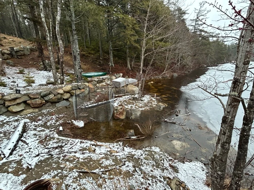
Landscape slightly covered with snow and with water levels covering the entire riparian area except for a mound in the center with trees growing from it

March 2026 view of the restored floodplain with high water levels reaching the back of the riparian zone
A vegetated riparian zone with boulders scattered throughout and trees growing on a mound in the center.

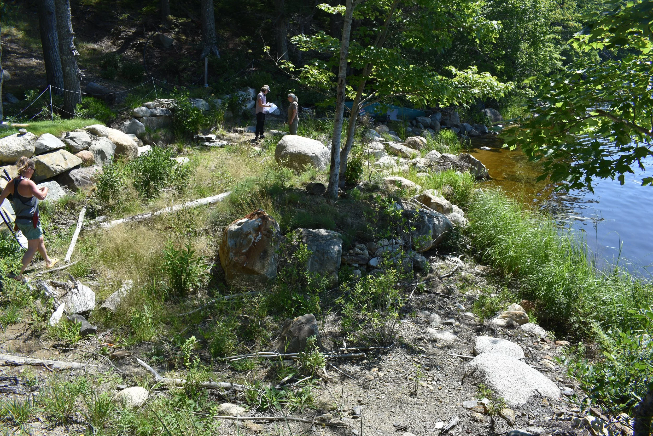
Compared to a slightly higher than average summer water level from the same vantage point (slightly more zoomed in) in August 2026

These flood waters may contain seeds and rhizomes that could facilitate the re-establishment of additional riparian vegetation, including Redroot. 

year 1 visit

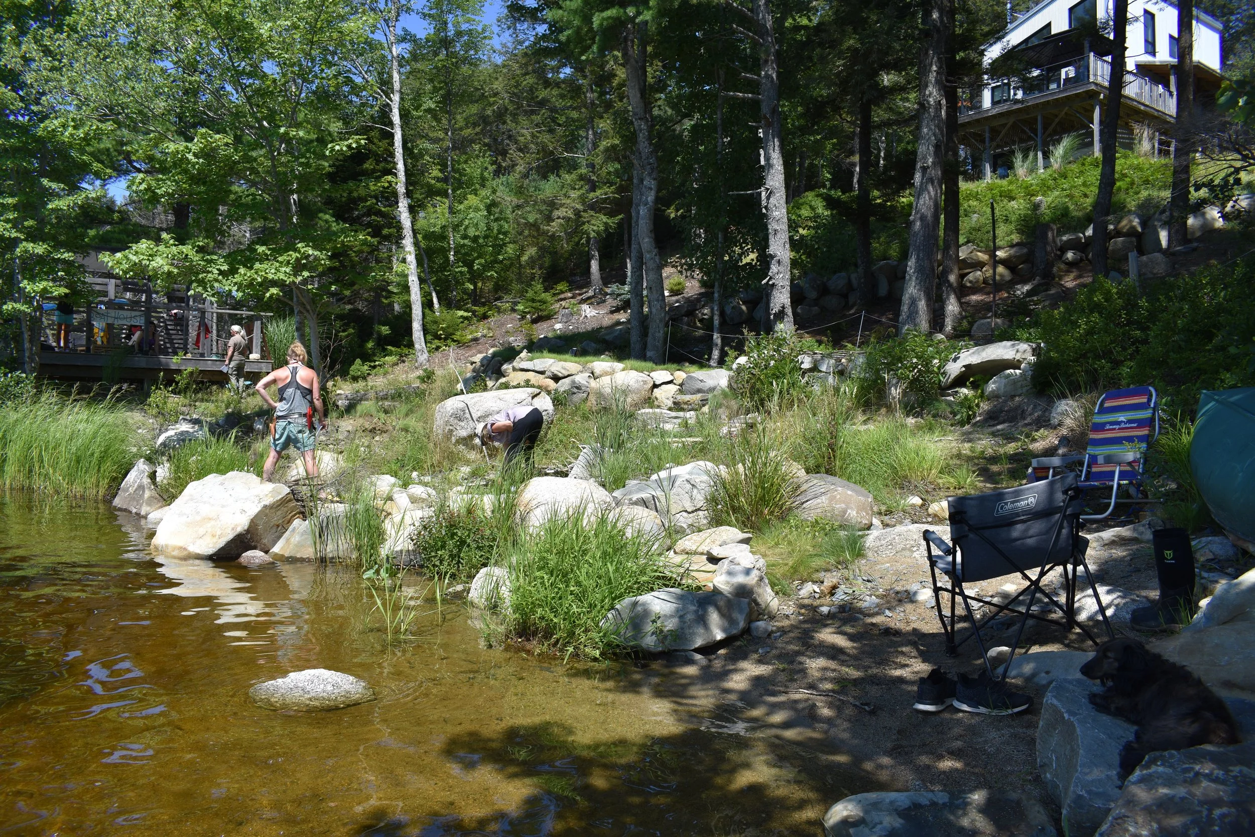
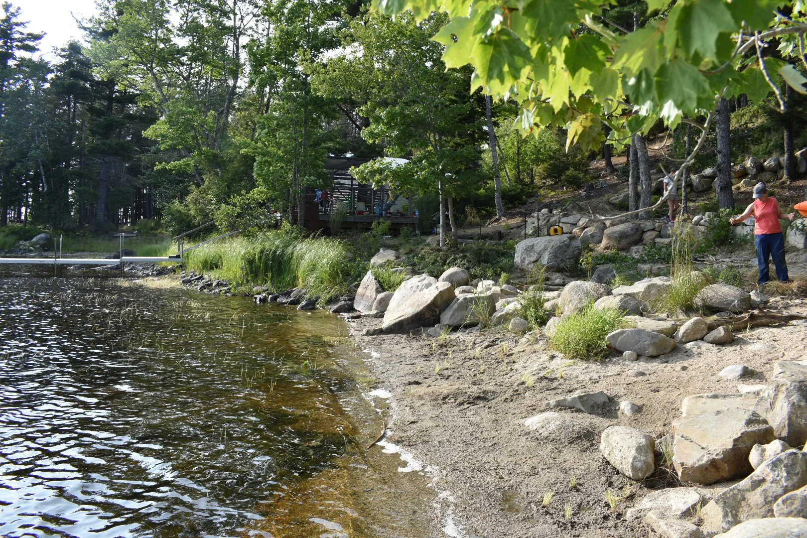
When we arrived on a lovely sunny day, the riparian vegetation was flourishing! The water level was much higher this year compared to during implementation in 2025.  
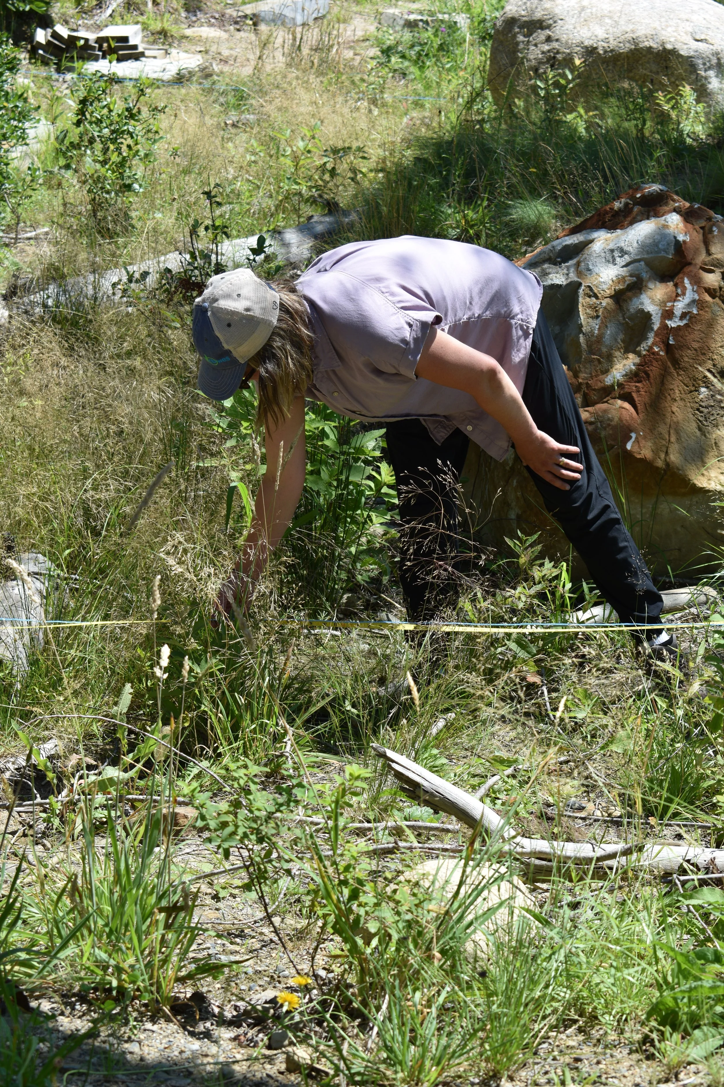
As part of the monitoring program, we set up transects along which we measured the slope and most prominent groundcover (i.e. plant species, bare ground, organic material, etc.). The team checked plant survival across the entire site and surveyed the organic material by size. These surveys can be compared over the years, which will indicate how materials are moving and shifting around onsite. 
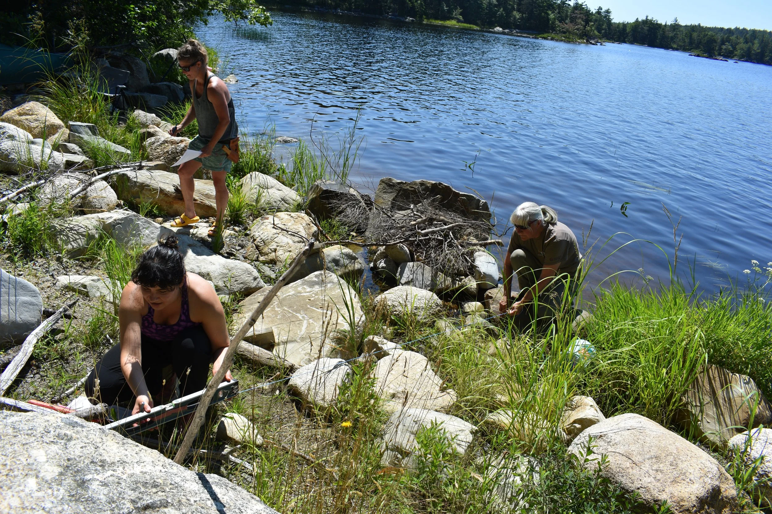
Some non-native species established throughout the first year. While not invasive, they were removed to maximize space for native species in the riparian zone. 

During our August 6 site visit, most of the native flowering plants were no longer in bloom, which made plant identification slightly more difficult for the less seasoned eye. Kirsten Ellis from CBWES and Rising Tide Nursery supported the homeowners in identifying the plants even when they are not in bloom.

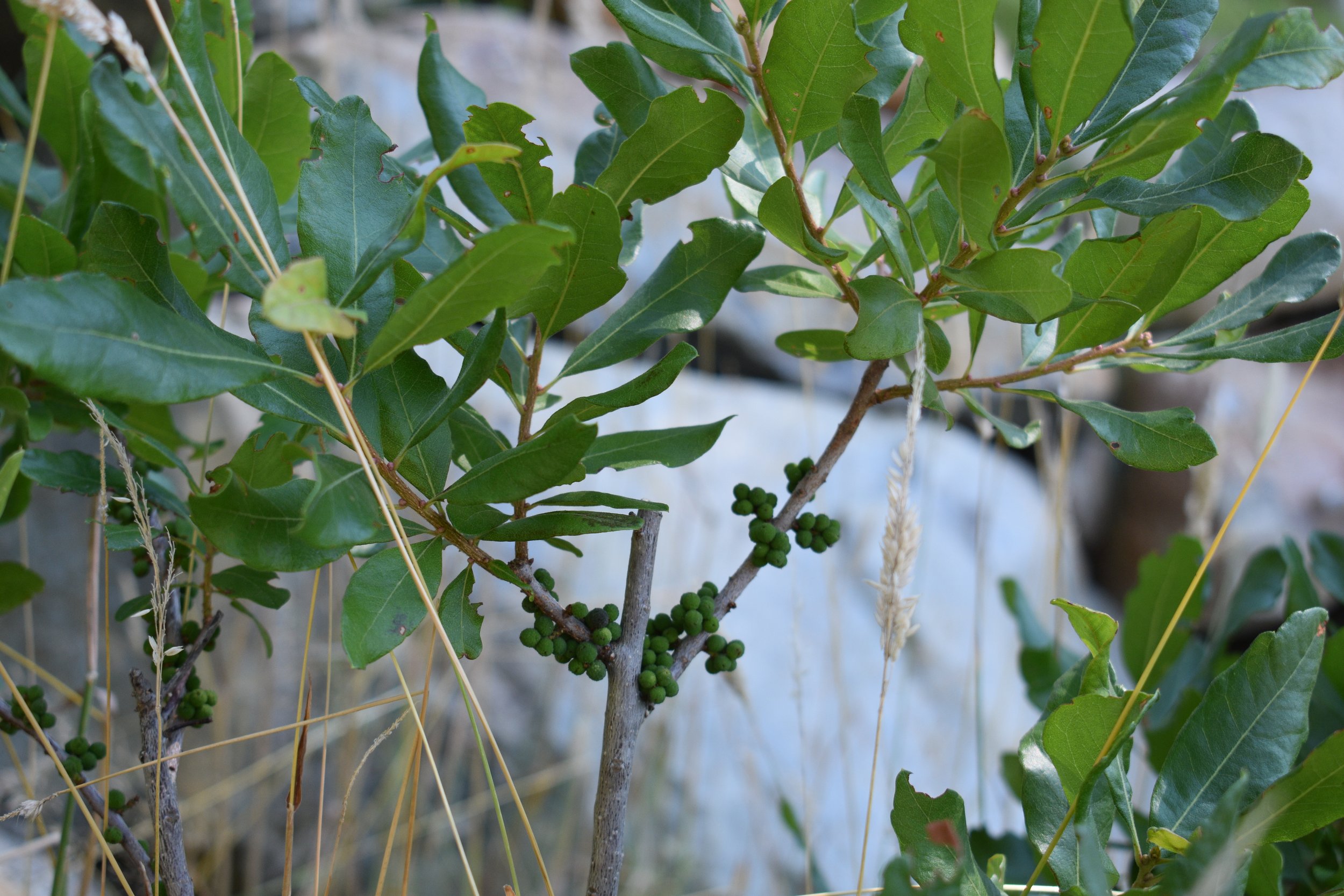
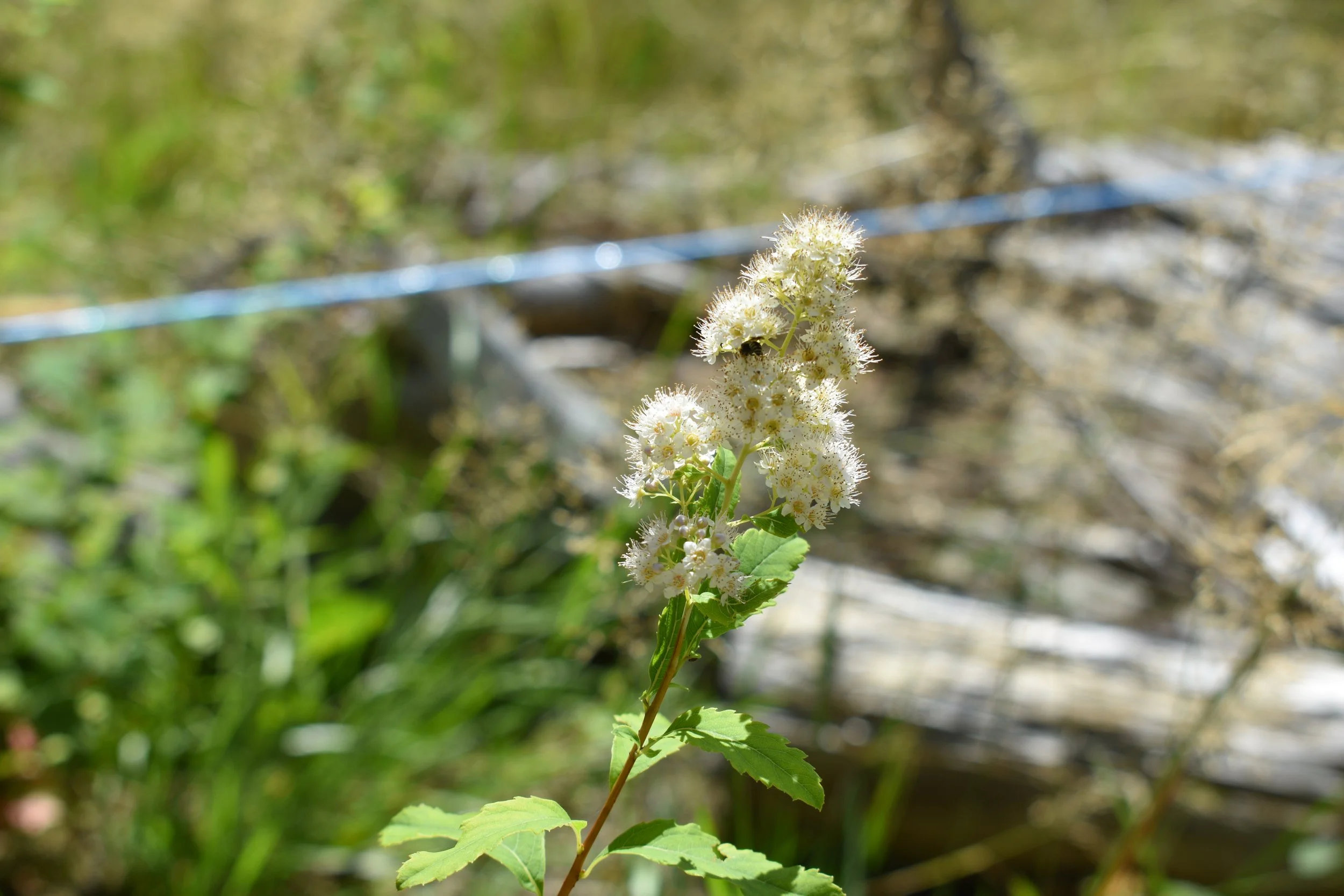
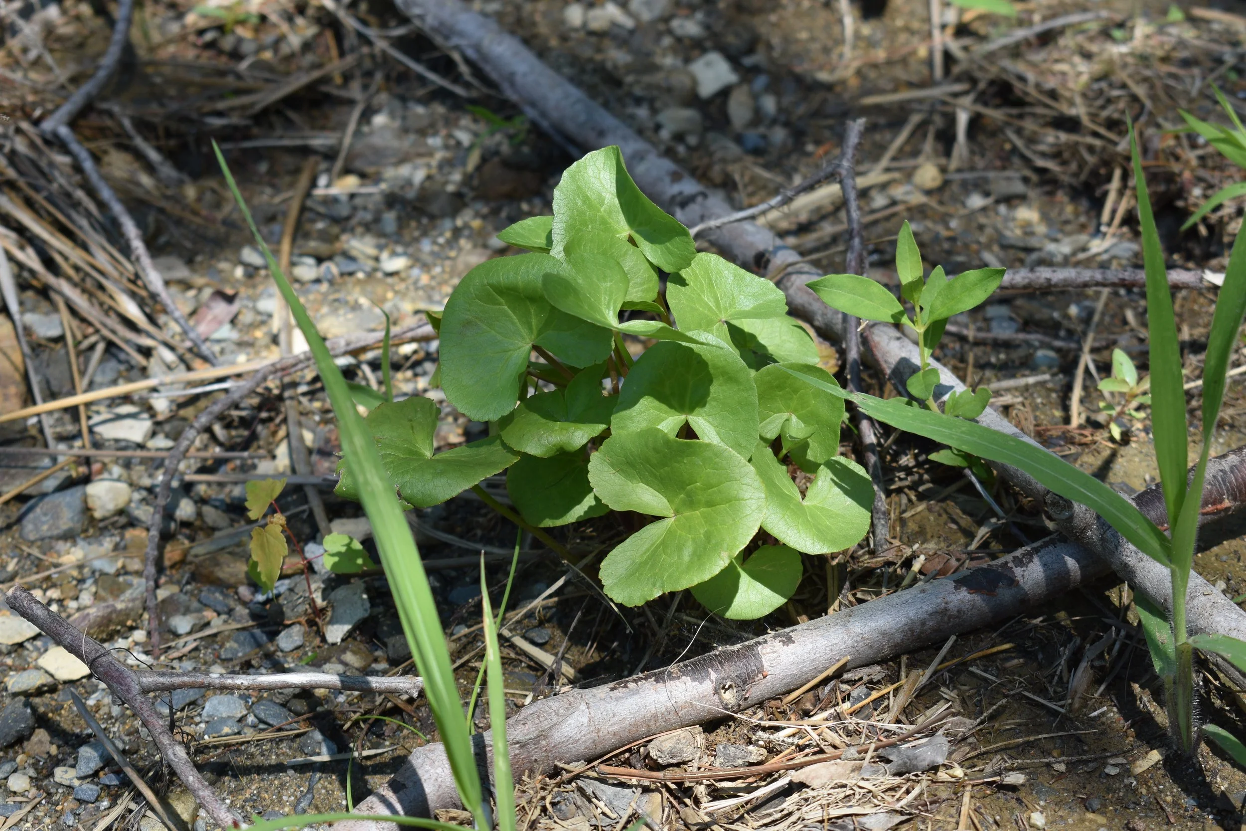
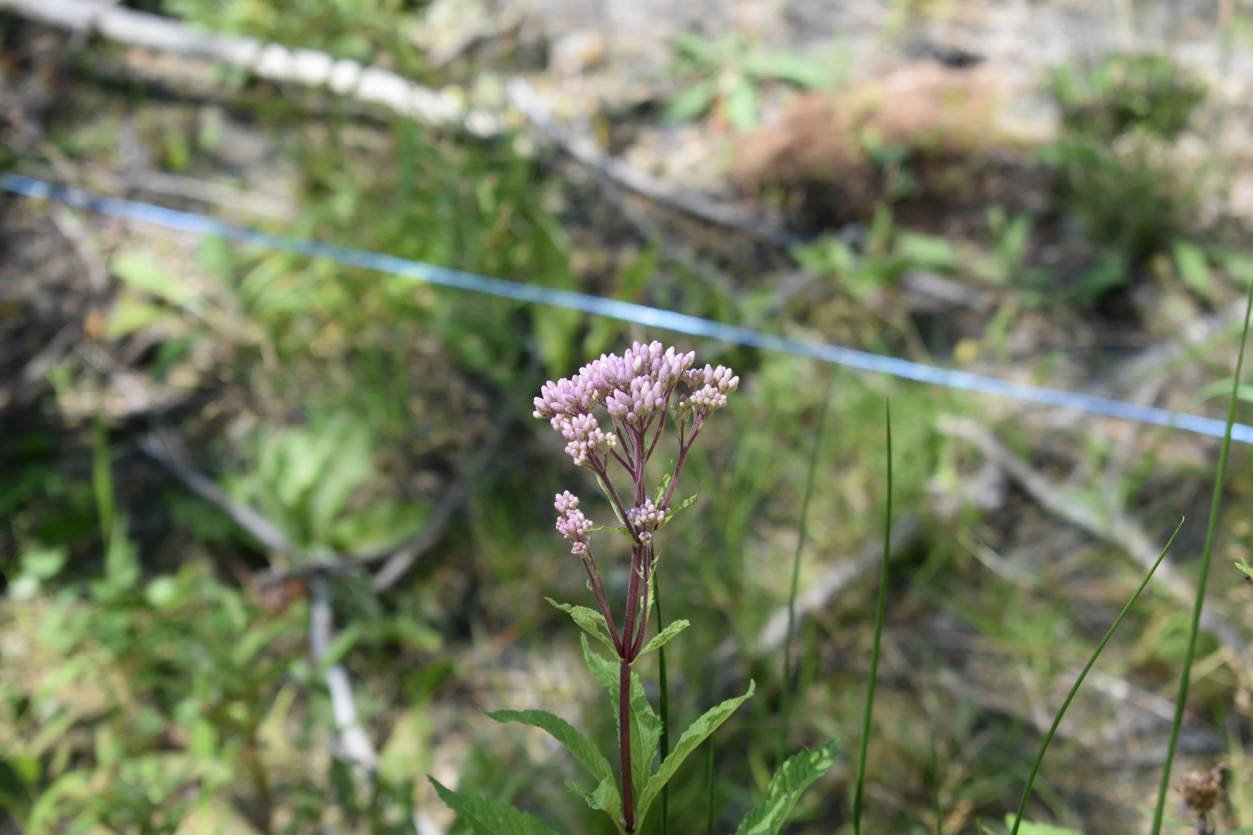
Some of the native species that were planted and are now thriving in the restored area include: 
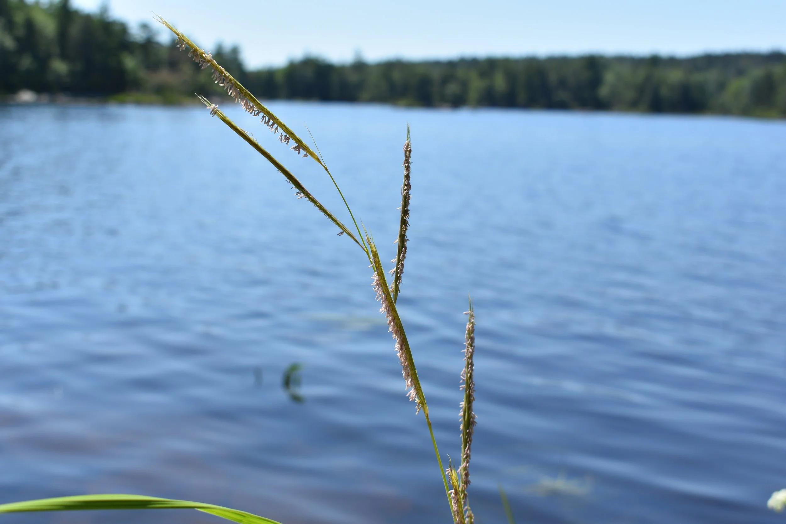
While surveying the site, we found Redroot growing in the restored area!

While we only officially found one to two plants that weren’t there before, it’s a great sign that the rhizomes and/or seeds are spreading throughout the system into the newly available habitat. 
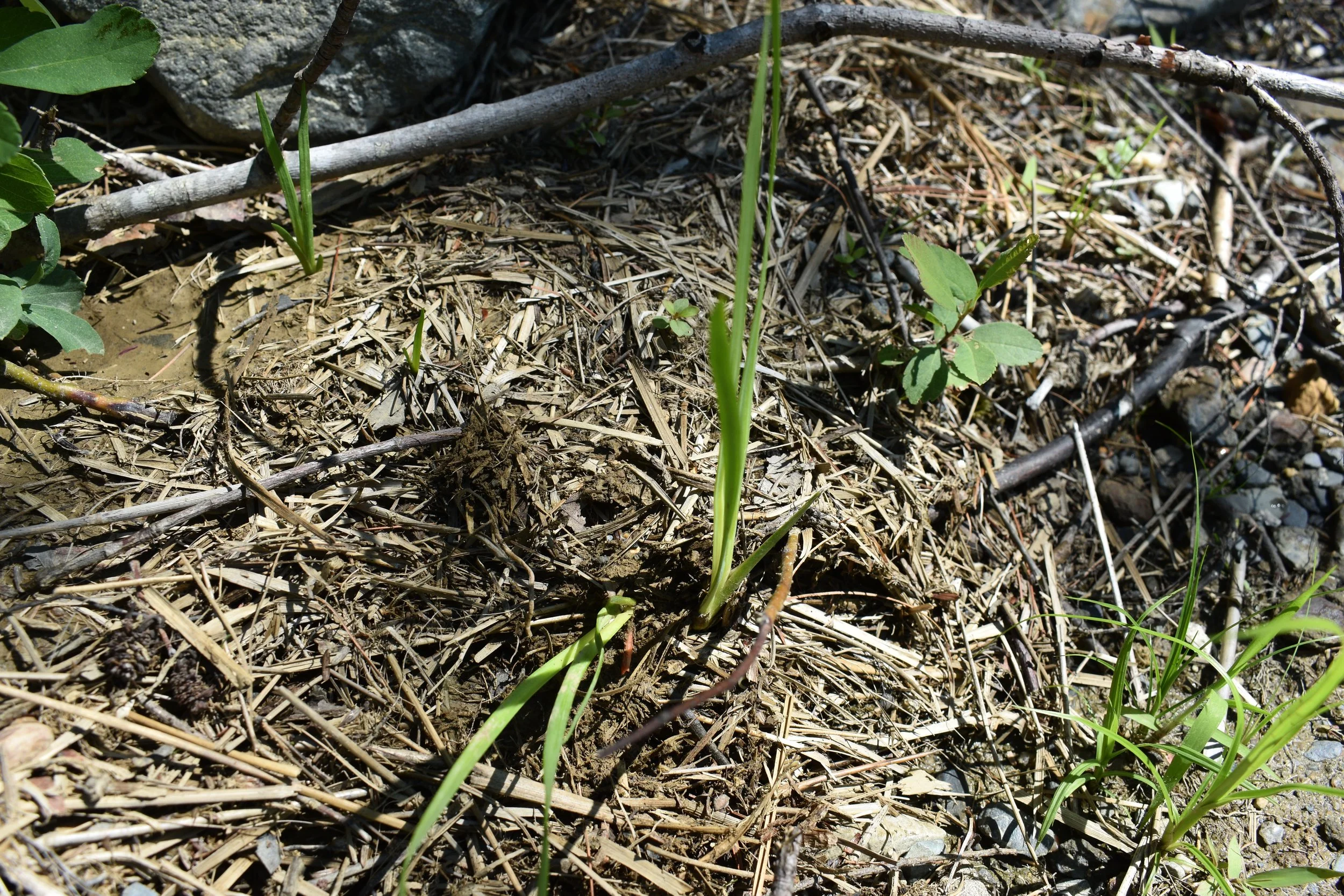
Two Redroot plants growing in wrack along the restored lakeshore at Molega Lake. 
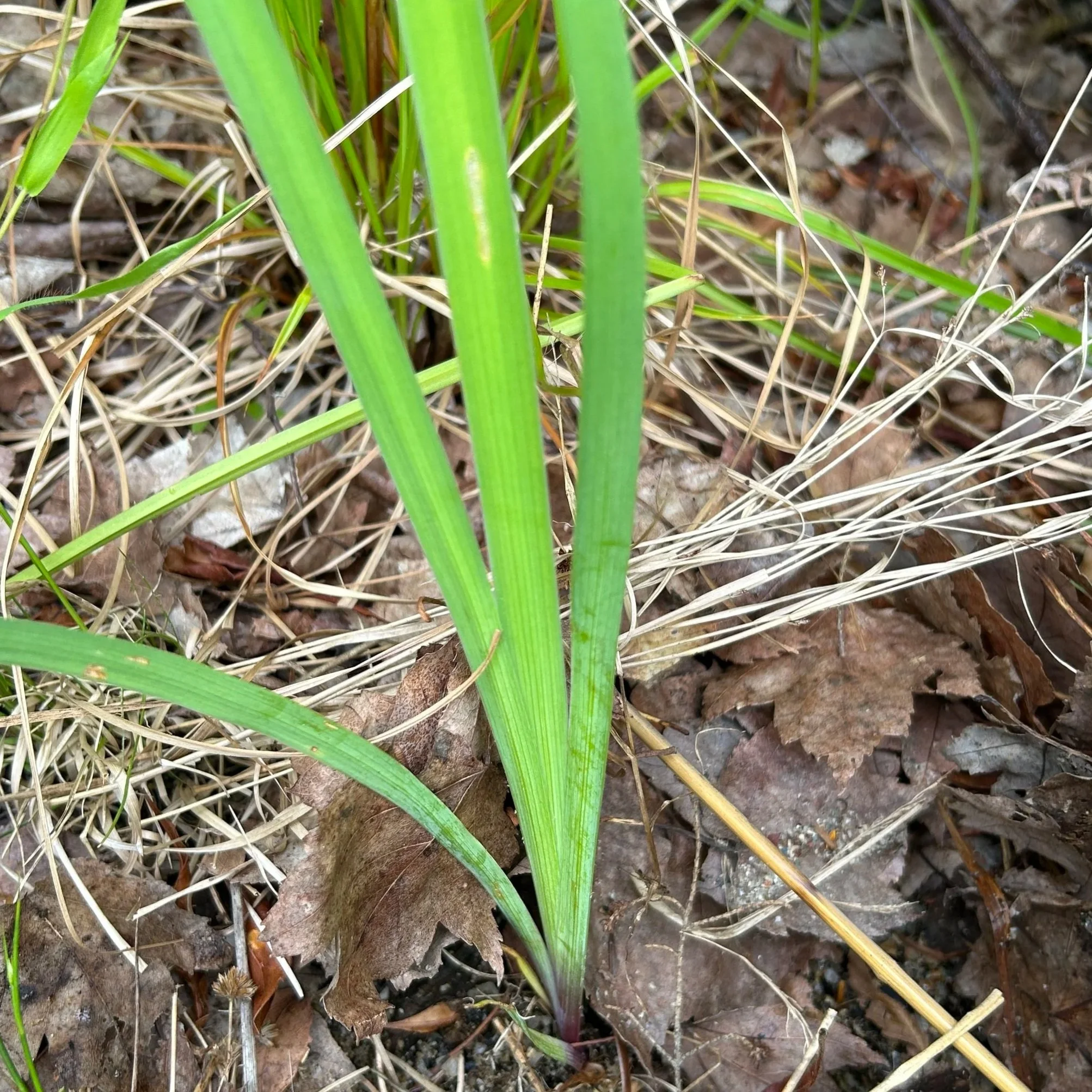
Blue flag iris growing at Molega Lake. Note the similar leaf/blade look to Redroot – photo: Kirsten Ellis. 

Redroot is aptly named for its red roots – check out the fallen over plant above; just beneath the soil, its red roots are poking out. These two specimens were found less than a meter above the waterline growing in a pile of wrack. 

Redroot can be easily confused with Blue Flag Iris (Iris versicolor), as their leaves and stems look extremely similar when not flowering.

However, the easiest way to tell them apart is that Redroot has, well, red-orange roots! The below photo from 2025 on an undisturbed portion of shoreline on Molega Lake shows just how red these roots can get. 
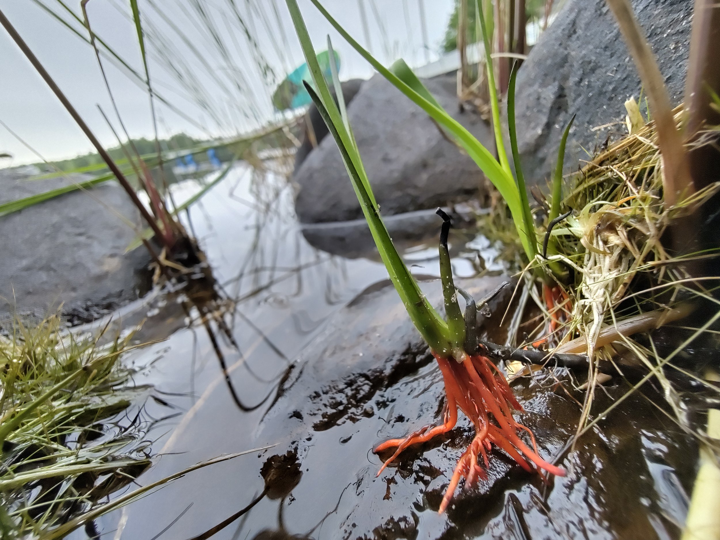
Redroot growing on a regularly flooded stone during the 2025 field visit. 

According to COSEWIC (2009), Redroot’s abundance within its habitat is highest on gentle slopes with broad shoreline widths that are flooded annually. They can grow in water up to 10cm deep, but tend to prefer the water’s edge, on shallow soils and cobbles. Like other ACPF species, Redroot relies on these nutrient-poor areas with wave action and ice scour to reduce competition with species that can’t handle that level of soil disturbance. Shoreline alterations (especially infilling and hardening, both of which are so common along Molega Lake) are cited as the main driver for this species’ threatened status (COSEWIC, 2009).
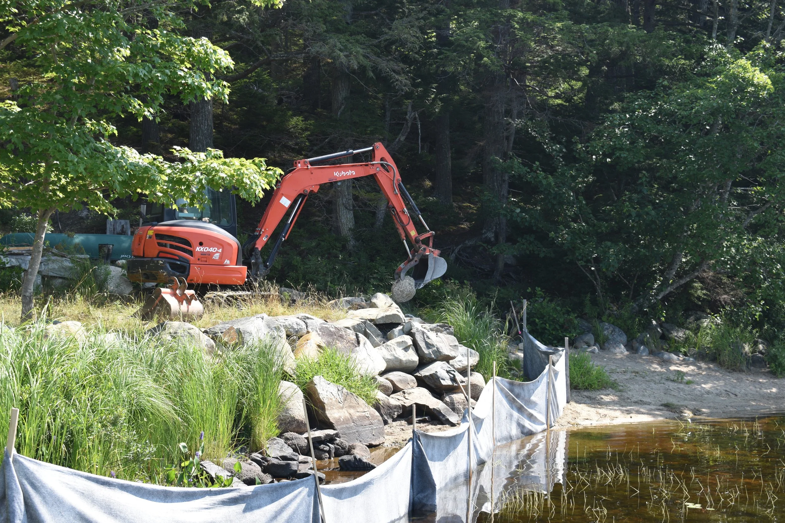
A shoreline with silt fencing, rock wall, and an orange excavator removing rock.

Excavator removing the armour stone from the rock wall during restoration, 2025. Manzer Brothers Excavation & Earthworks removed approximately 76 cubic meters of infill to restore the gentle slope of the natural riparian zone. Note the narrow space between the rock wall and water level – too narrow for Redroot! 

Nearly 90% of available Redroot habitat in Nova Scotia is privately owned, meaning long-term survival of this species and its habitat is hugely dependent on the stewardship actions of private property owners along Molega and Ponhook Lakes (and a few neighbouring connected lakes).  

The Green Shores for Homes program is readily available to any private property owners in the Maritimes interested in maintaining or restoring healthy riparian habitats for species like Redroot, turtles, birds, shrubs, and people!
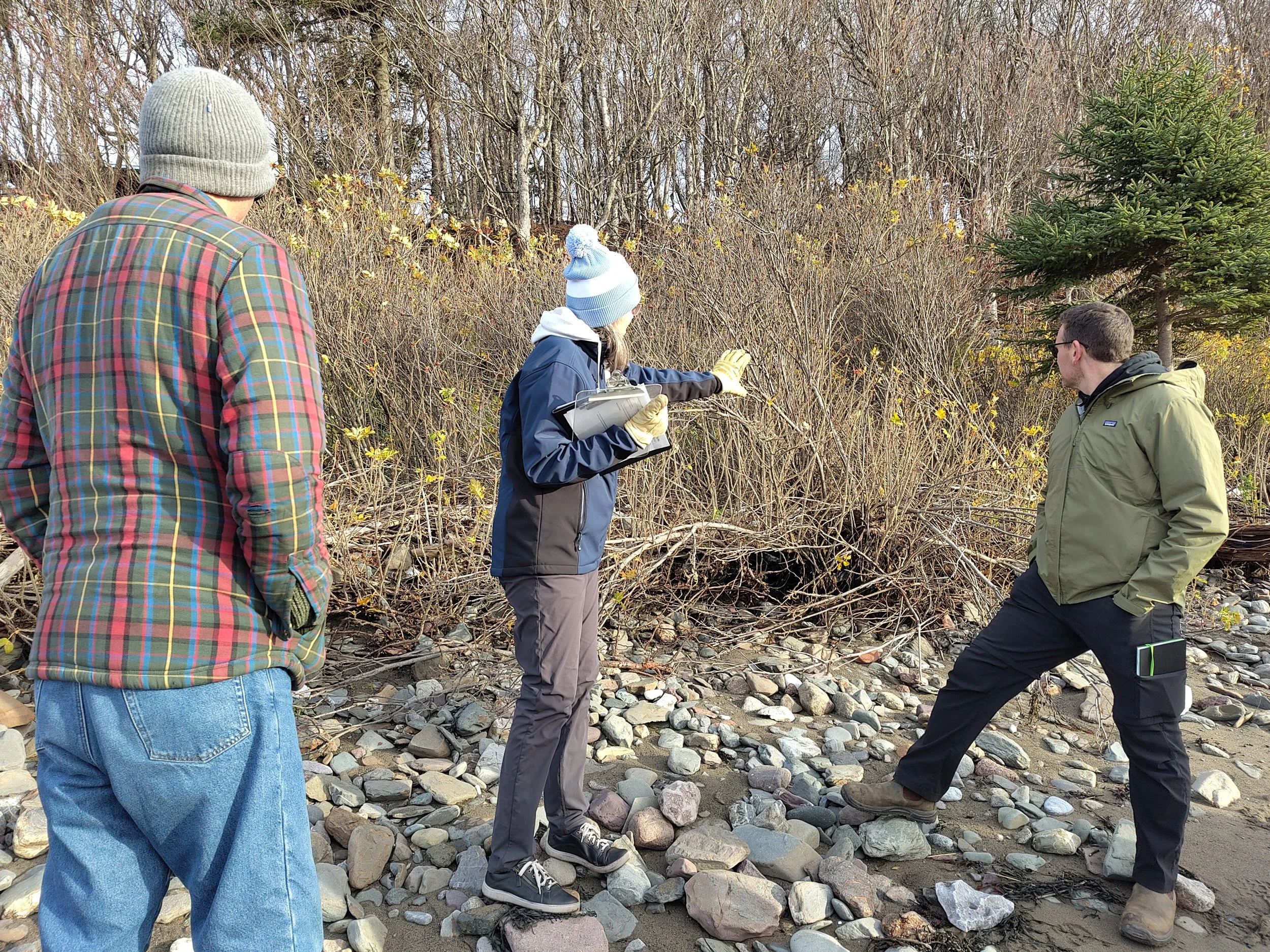
Three people wearing cold-weather gear standing on sandy rocks and looking at a thicket of Forsythia. The person in the center holds a clipboard and gestures towards the thicket

Trainees reading the shoreline and discussing how they could use nature-based approaches to improve shoreline resilience in Green Shores Level 1 training, November 2025. 

The program is applicable to both lakeshores and coastlines. Guidance is available for free in the guidebooks on our Green Shores for Homes page. If starting on your own seems daunting, TransCoastal Adaptations offers free training in the Green Shores program on a regular basis, so check out our Green Shores Training page for any upcoming training sessions near you!

If you have previously altered your shoreline and you had species like Redroot onsite, hope is not lost! As our Molega Lake site demonstrates, Redroot can return to a restored floodplain as soon as 1 year after restoration activities are completed. If you are considering altering your shoreline but are concerned that it may impact species at risk or the health of your shoreline in general, the new Green Shores website contains numerous resources that can support you in making the best decision for your property, and staff at TransCoastal Adaptations are eager to provide advice.
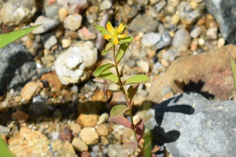
Canada St. John’s Wort (Hypericum canadense

Working with nature is one of the best ways to ensure a thriving shoreline habitat, water quality, safe access, and climate change resilience. 


References

COSEWIC. 2009. COSEWIC assessment and status report on the Redroot Lachnanthes caroliniana in Canada. Committee on the Status of Endangered Wildlife in Canada. Ottawa. vii + 34 pp. 

Environment and Climate Change Canada [ECCC]. (2026). Weather station 8202592 – Kejimkujik 1. March 2026 Data Report. Retrieved from: https://climate.weather.gc.ca/climate_data/daily_data_e.html?hlyRange=1994-02-01%7C2026-08-18&dlyRange=1993-04-01%7C2026-08-18&mlyRange=1993-01-01%7C2007-07-01&climate_id=8202592&Prov=NS&urlExtension=_e.html&searchType=stnProv&optLimit=yearRange&StartYear=2026&EndYear=2026&selRowPerPage=25&Line=20&Month=3&Day=18&lstProvince=NS&timeframe=2&Year=2026#legendM  

Umlah, K. & Giacomodonato, H. (2026). Molega Lake: Green Shores for Homes Case Study. 

Willick, F. (2026). N.S. farmers hope snowy winter will mitigate effects of drought. CBC Nova Scotia. Retrieved from: https://www.cbc.ca/news/canada/nova-scotia/n-s-farmers-hope-snowy-winter-will-mitigate-effects-of-drought-9.7110849  

Green Shores for Homes Gold Sites in Nova Scotia

Along the shorelines of Nova Scotia, land and water are constantly reshaping one another and small, thoughtful interventions can have an outsized impact. That’s where Green Shores for Homes comes in.

The Green Shores for Homes program helps homeowners protect and restore their shorelines using nature-based solutions. The program encourages the use of natural materials and designs to reduce wave action and mitigate risks such as erosion and flooding. Homeowners can enjoy benefits like increased accessibility for activities, improved habitat for wildlife, and enhanced security against erosion and flooding.

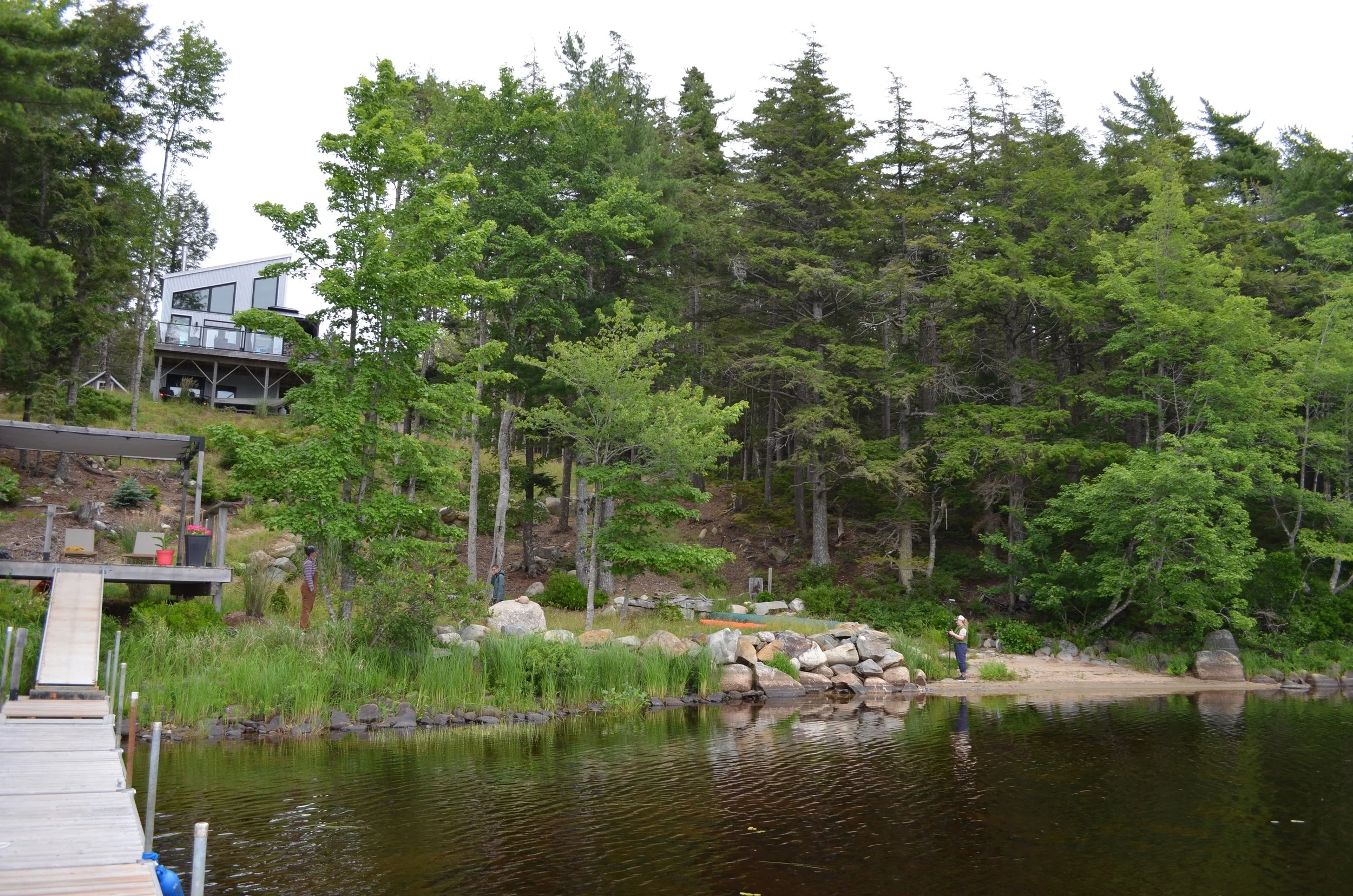
Restored lakeshore riparian zone on Molega Lake

In 2023, the Green Shores for Homes program evolved to better reflect the realities of the Atlantic coast. It introduced new guidance tailored to this region and a new credit designed to support stewardship of Species at Risk (SAR) habitat.

Welcome to Kespukwitk

Kespukwitk is a Mi’kmaq province, which translates to “end of flow,” as it’s an edge of Mi’kma’ki, the unceded and traditional territory of the L’nu. The Kespukwitk region is one of 11 priority places across Canada due to both its biodiversity and its cultural value.

This region is home to an extraordinary concentration of life. 94% of Nova Scotia’s terrestrial SAR can be found is the Kespukwitk/Southwest Nova Priority Place. Among these are Atlantic Coastal Plain Flora (ACPF), a group of at-risk shoreline plants that are highly specialized to wet areas, such as lakeshores, wetlands, and estuaries along the Atlantic coast of North America. The rarest of the at-risk ACPF in Canada grow almost exclusively within the Kespukwitk region.

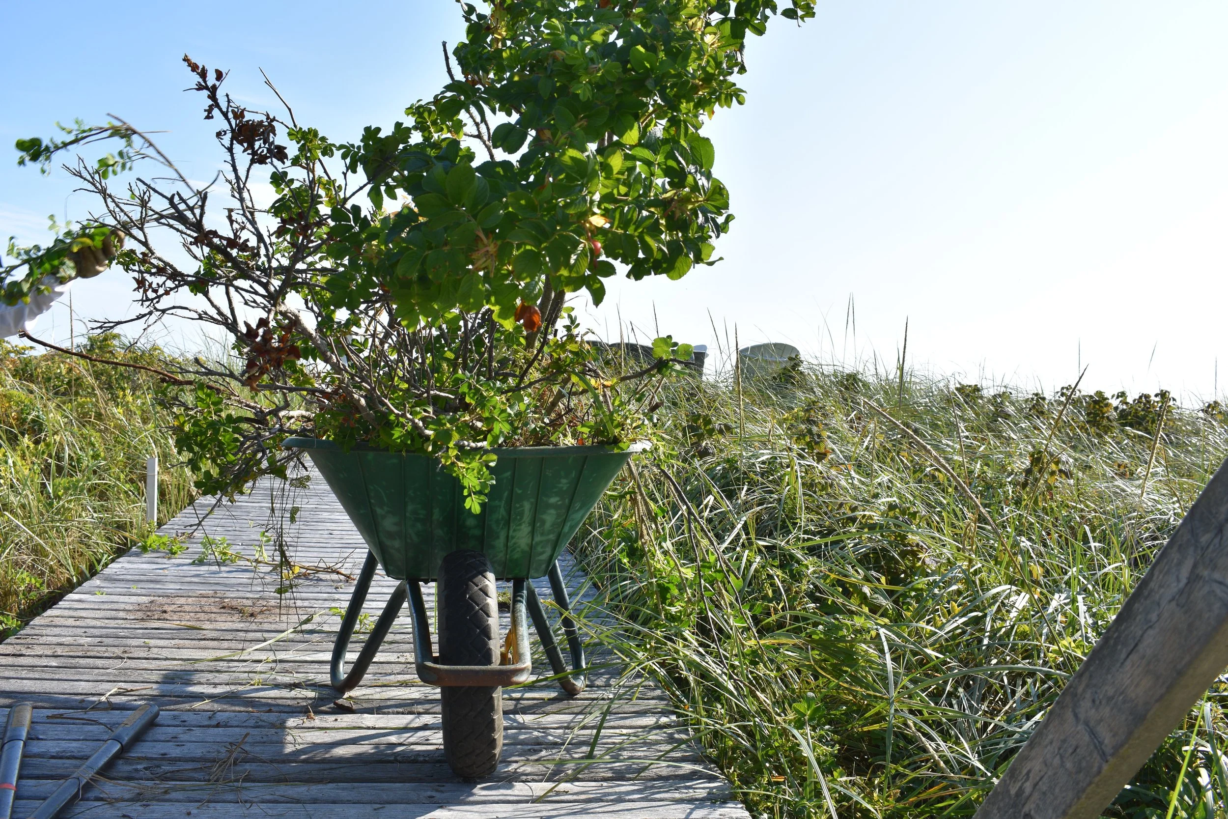
Invasive rose removal on Kingsburg Beach dunes

Eighteen shoreline SAR were identified as target species for which our projects could benefit:

*Species with an asterisk are ACPF.

To test the new Green Shores for Homes (GSH) Credit 2.1: Enhanced Critical, Sensitive, and Migratory Bird Habitat Stewardship, Environment and Climate Change Canada supported TCA to implement two projects within the Kespukwitk Priority Place. We wanted to explore how the credit could benefit SAR both on a coast and on a lakeshore, on a restoration site and on a relatively unaltered site.

Throughout 2024, we searched for home or cottage owners with properties on the shorelines mentioned above and who had at least one of our target 18 SAR onsite. We were fortunate enough to find two properties that met all the criteria we were looking for!


Molega Lake

The site visit before construction showing the rock wall, fill, and artificial beach to the right.

At Molega Lake, the shoreline told a familiar story. Years earlier, infilling and armouring had reshaped the land by burying natural substrate, removing habitat, and destroying habitat for at-risk species.

Only 4 years earlier, the Mersey Tobeatic Research Institute had recorded Redroot (an at-risk ACPF species) on-site. Now, it had completely disappeared. Endangered reptiles also could be found in the area, but the clay fill and rock wall wasn’t being used as nesting habitat since there were more suitable sites elsewhere on the lake.

In the summer of 2025, restoration began on the Molega Lake project. CB Wetlands and Environmental Specialists (CBWES) collected the background data and designed the project and their Rising Tide Nursery supplied the majority of the native plant species that were planted onsite. TransCoastal Adaptations staff supported CBWES on the project.

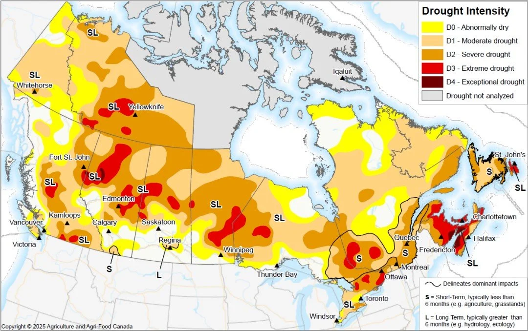
Sept 2025 Drought conditions

Nova Scotia experienced severe, extreme, and in some areas, exceptional drought conditions by September 30, 2025. (Source: Agriculture and Agri-Food Canada Drought Monitor).

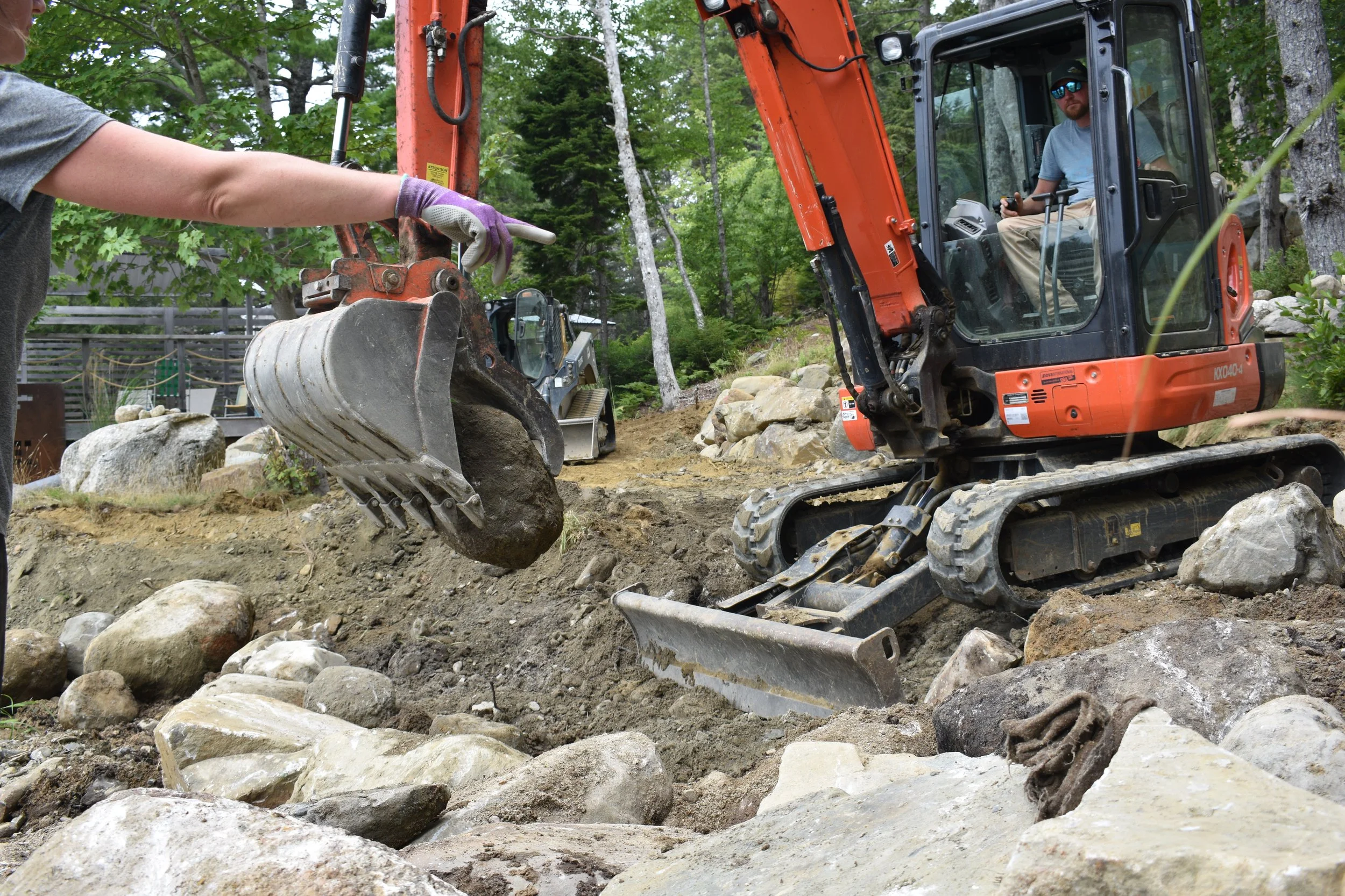
CBWES directs Manzer Brothers on where to place repurposed retaining wall rocks in the riparian zone.

To address prior destruction of ACPF habitat, Manzer Brothers Excavation & Landworks removed over 76 cubic meters of infill to re-expose much of the natural substrate.

The rock wall was dismantled, and the rocks were placed throughout the riparian zone in a manner that reflected the neighbouring natural shoreline.

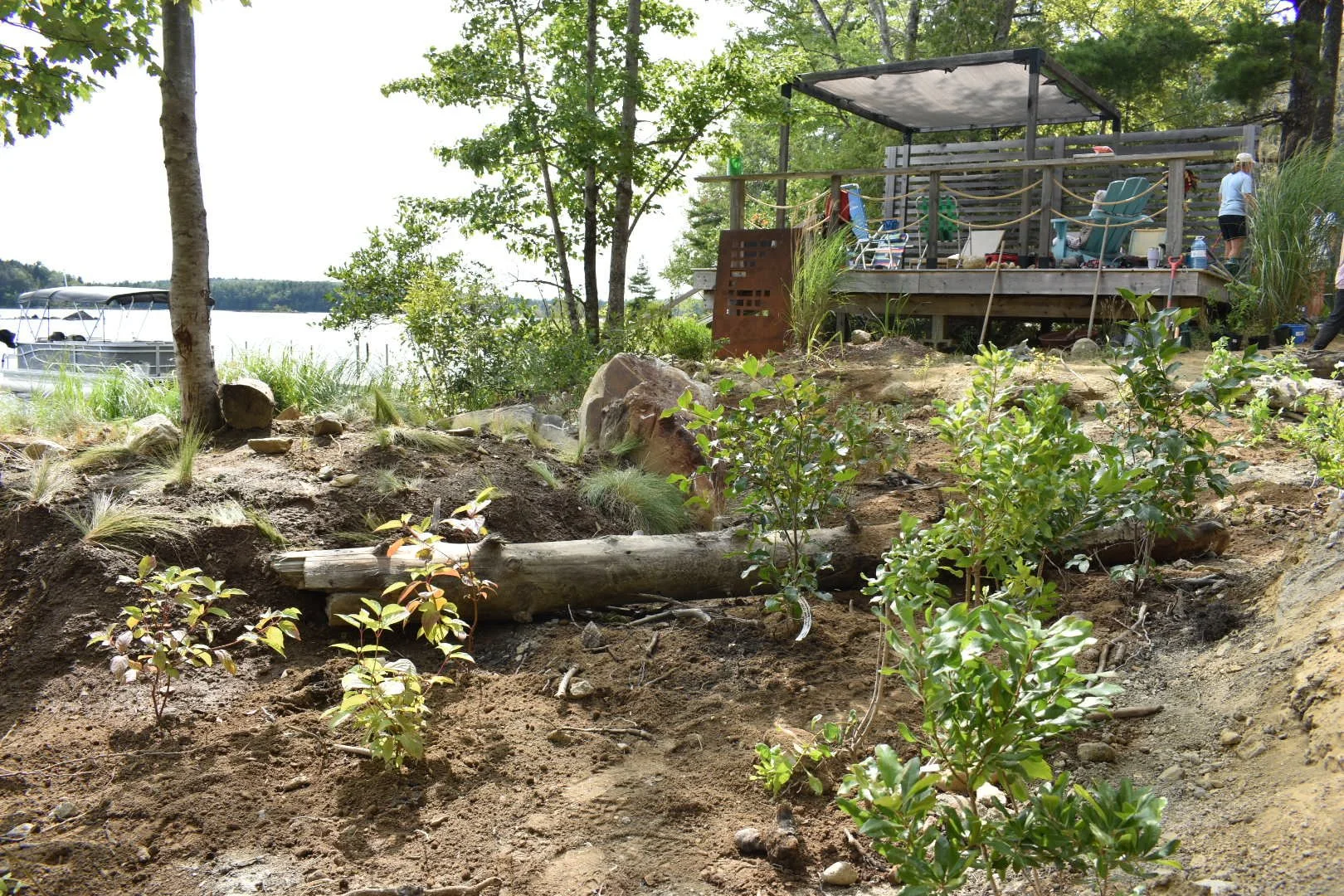
Over 322 native grasses, rushes, flowering perennials, and ACPF shrubs were planted in the riparian zone. Due to this summer’s severe to extreme drought conditions, water levels were far lower than usual, and plants were stressed. The team adapted in real time, incorporating additional watering and care to ensure the plants survived.

By the end of the season, a remarkable 150 square metres of habitat had been restored! The shoreline could once again function as a living system, supporting rare plants, fluctuating lake levels, and at-risk reptiles.

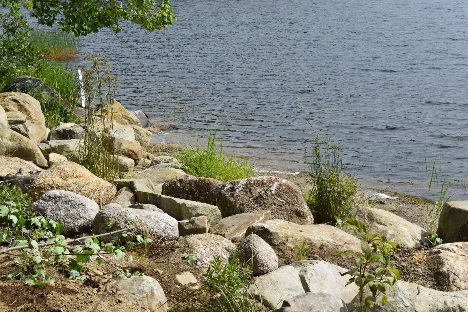
Restored Riparian Zone

The connectivity between the water and land has been restored, the artificial beach removed, and the riparian zone planted with native lakeshore species.


Kingsburg Beach

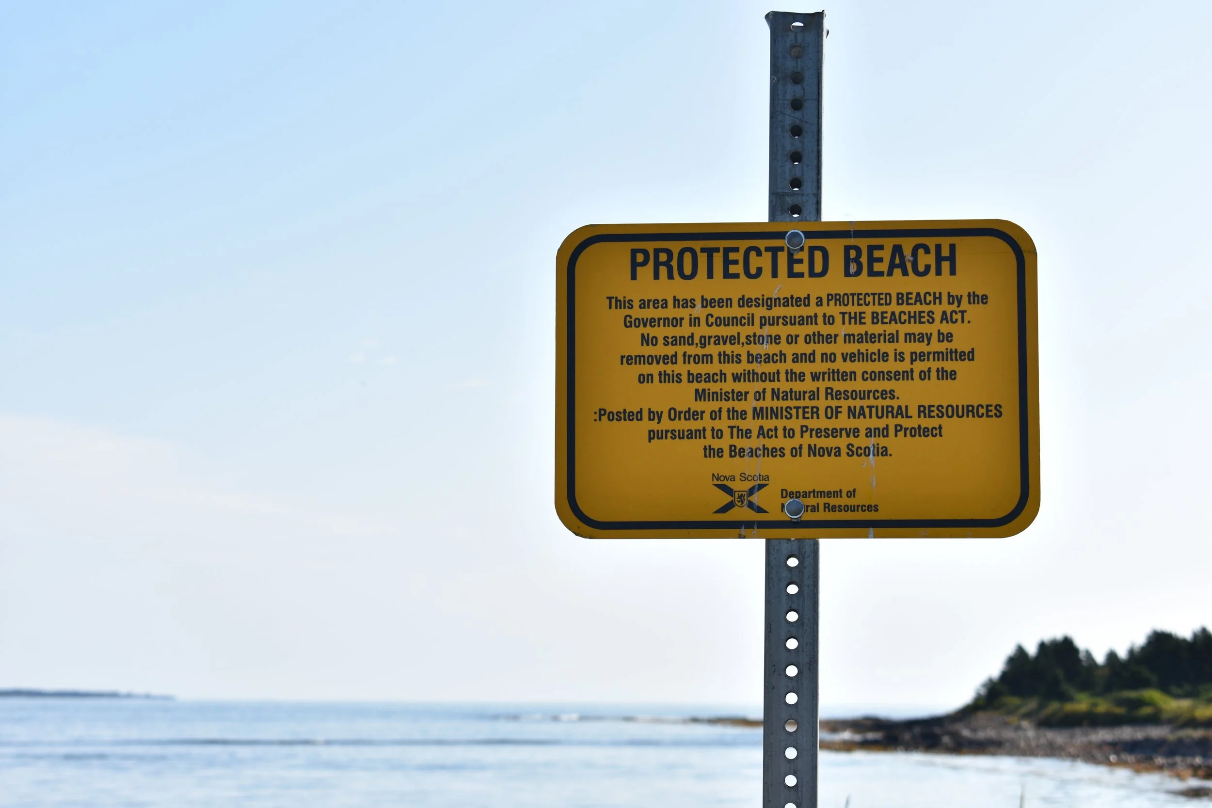
Protected beach signage provided by the Department of Natural Resources NS.

On Kingsburg Beach, the challenge was different. Here, the coastal dune system had minimal disturbance. However, we were starting to see some storm erosion and compaction from vehicle traffic on the dunes. The habitat is critical for foraging Piping Plovers and Bank Swallows and had been designated as a protected beach by the provincial Department of Natural Resources. Here, the goal was to work with the system and guide human behaviour to better support it.

The Kingsburg Beach project was implemented in early September of 2025. Helping Nature Heal Ltd. (HNH) designed the project across multiple properties across the beach. HNH supplied the grasses, shrubs, and organic material (wattle fence stakes, veggie groyne, Abundance fertilizer) for the installation.

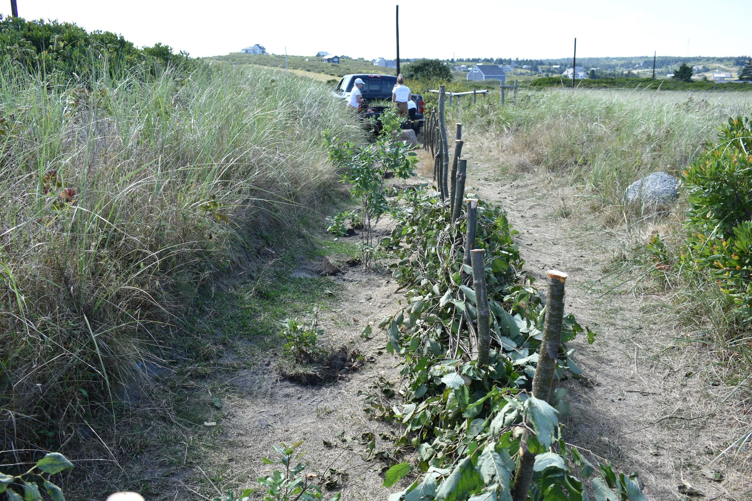
Rather than restoring a destroyed habitat, the alterations to this system were mainly to adjust human behaviour to better protect the dune system. A wattle fence made of alder stakes and branches dissected a right of way on the property to only allow for pedestrian traffic. The right of way had originally been the width of a large vehicle, allowing vehicles to drive onto the beach and compress the ground below. Shrubs were planted on the restored part of the right of way in an effort to release some of that compaction.

Wattle fencing in progress

Native dune shrubs were planted to the left of the wattle fence. To the right, a pedestrian path remains for beach access.

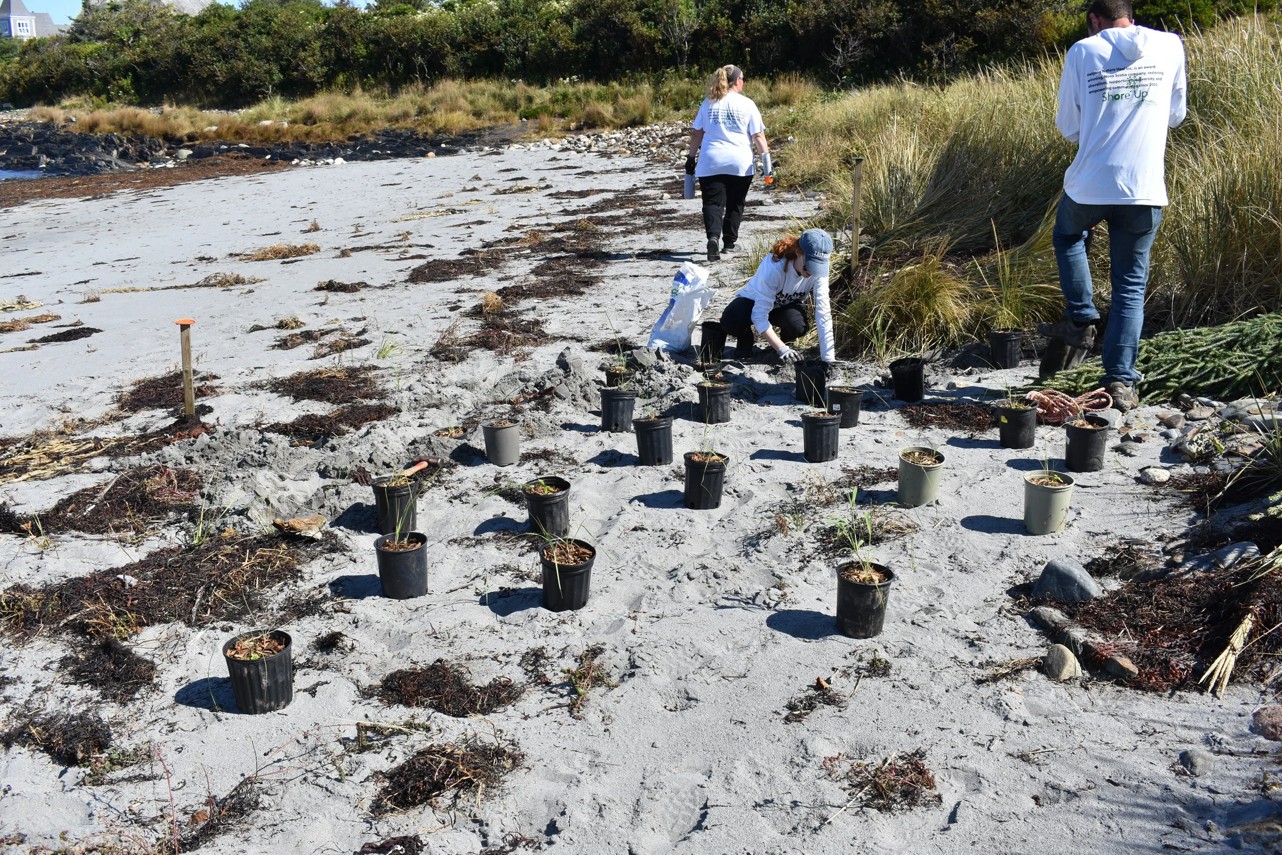
Planting dune grasses at the dune toe near the veggie groyne installation.

Our team also removed invasive roses on the dunes, installed a sand capture technique called a “veggie groyne,” and planted dune grasses. These efforts will support natural dune rebuilding after storm erosion from the prior year.

However, the team didn’t end up planting as many dune grasses as we anticipated because the dune was already building itself back up quite well — a testament to how resilient the ecosystem already was.

Green Shores Ratings

Both projects achieved a gold rating through the Green Shores for Homes program! Below is a table of the credits that shows which credits each project received points under.

Credit Molega Lake Kingsburg Beach
1.1 No Shoreline Protection Structures x
1.2 Setback/Impact Avoidance x x
1.3 Hard Armour Removal x
1.4 Groin Removal
1.5 Nature-Based Erosion and Flood Management
1.6 Managed Retreat
2.1 Enhanced Critical, Sensitive, and Migratory Bird Habitat Stewardship x x
2.2 Riparian and Emergent Vegetation x x
2.3 Trees and Snags x
2.4 Invasive Plants x
2.5 Organic Material x x
2.6 Overwater Structures x
2.7 Access Design x x
3.1 Site Distrurbance
3.2 Reduce and Treat Runoff x
3.3 Environmentally Friendly Building Products
3.4 Creosote Material Removal
3.5 Herbicides, Pesticides, and Fertilizers x x
3.6 Onsite Sewage Treatment x
4.1 Shoreline Collaboration x
4.2 Public Information and Education x x
4.3 Conservation Easement or Covenant
4.4 Shoreline Stewardship Participation x x

A Shared Outcome

Beyond the rating, these projects tell a larger story. They show that nature-based solutions are not one-size-fits-all. Sometimes, restoration means removing years of damage. Other times, it means stepping back and gently redirecting human impact. In both cases, success comes from understanding the system—and working with it, not against it.

As more communities across Atlantic Canada look toward climate adaptation, these projects offer a hopeful path forward: one rooted in restoration, stewardship, and respect for the landscapes that sustain us. For more in-depth detail, stay tuned for the release of our case studies, which include costs, drawings, construction details, point breakdowns, and more!

Check out the Green Shores website for more details.