Promoting sustainable and resilient ecosystems throughout Canada.

NSERC ResNet: A network for monitoring, modelling, and managing Canadian ecosystem services for sustainability and resilience unites a broad community of scholars and resource managers from across academic, government, NGO, and industry sectors to identify paths for sustainable landscape management that ensure biologically diverse, resilient, and adaptive social-ecological systems amid the complexity of competing values, stakeholders, and political jurisdictions.
Bay of Fundy Dykelands
ResNet has launched investigations, co-designed with local industry, government, NGO, and Indigenous partners and other stakeholders, into the provision, modelling, and governance of multiple ecosystem services in six working landscapes across Canada. One of these landscapes is the Bay of Fundy Dykelands in Nova Scotia, where TransCoastal Adaptations contributes to ResNET research co-led by Dr. Jeremy Lundholm and Dr. Kate Sherren.
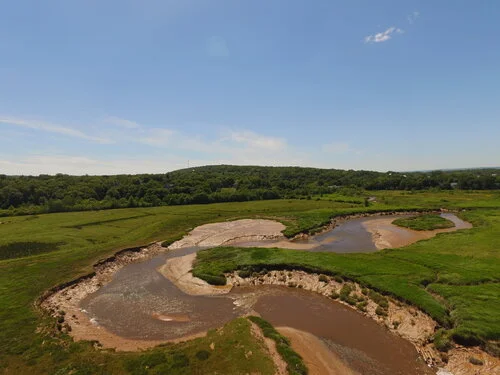
Dykelands develop heterogeneously due to local planning, agricultural viability, and conservation and engineering decisions. TransCoastal Adaptations’ research involves quantifying ecosystem services provided by dykes and tidal wetlands, including carbon sequestration, protection of coastal properties from erosion, provision of habitat for fish and other wildlife, cultural ecosystem services, agricultural production, pollination and other services. Finally, our research will establish a limited set of key variables to monitor to ensure balanced environmental service delivery into the future.
Landowners in the Bay of Fundy face difficult dyke-management choices as a result of sea-level rise (SLR) and other effects of climate change. The goal of this research is to build an evidence base that will help local communities in the Bay of Fundy make informed and effective decision-making around dyke management in order to build local resilience.
Research
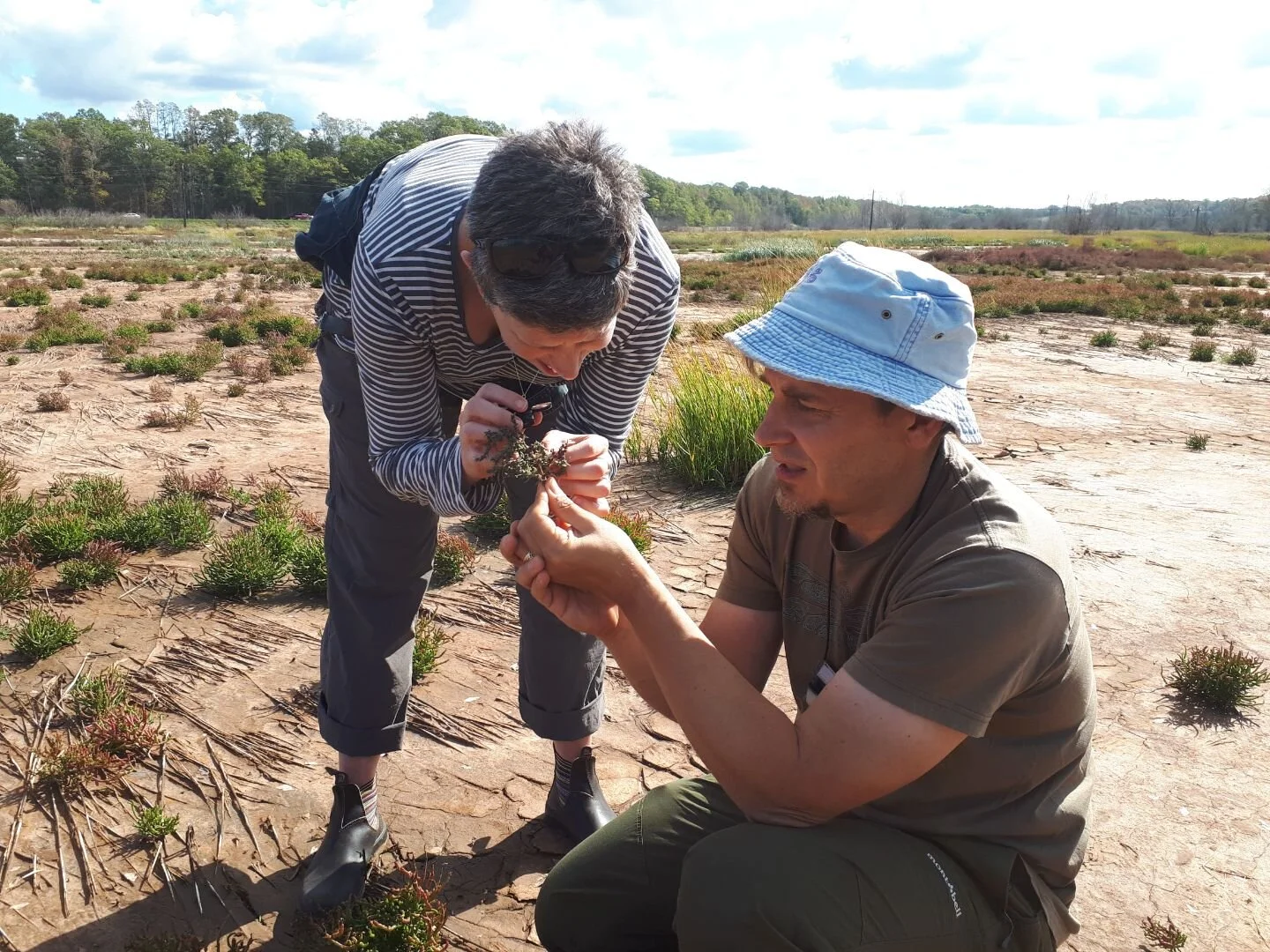
COMPARISON OF POLLINATOR ASSEMBLAGES ON AGRICULTURAL DYKELANDS IN THE BAY OF FUNDY
Researchers Terrell Roulston and Evan McNamara investigate wild pollinators in Bay of Fundy agroecosystems and the services they provide, which include increasing crop yields and maintaining natural plant communities.
Roulston is researching the role of dykelands and saltmarshes adjacent to croplands in supporting the health of local pollinators. Roulston’s research has found a similar abundance of pollinators in both habitats, and has found pollinators such as Bumble Bees and Leaf-cutter Bees visiting wind-pollinated saltmarsh grass Sporobolus alterniflorus, which is unexpected.
McNamara is investigating differences between pollinator assemblages on farmlands in the Bay of Fundy based on their proximity to dyke and saltmarsh ecosystems.
This research will help farmers understand the value of pollination services to their crops, and the related costs and benefits associated with processes such as dyke realignment and saltmarsh restoration.


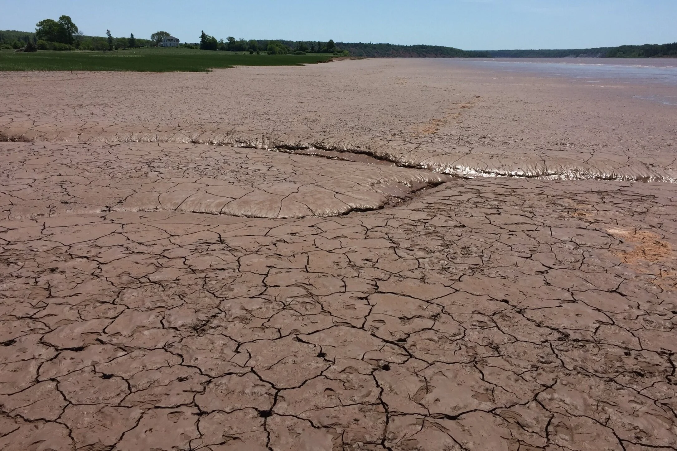
Salt marsh Sediment accretion
Researchers Élise Rogers and Megan Elliot investigate the spatial and temporal variabilities in sediment flux on restored salt marshes, and how these relate to sediment accretion on the marsh.
They measure sediment flux parameters in various seasons to calculate sediment flux. Additionally, they measure changes in salt marsh elevation and accretion over time. With the resulting data, they are able to better understand the relationship between sediment flux and salt marsh accretion.
The findings from this research will help predict tidal wetland restoration timeframes with increased accuracy, and help us understand how salt marshes adapt to rising sea levels.


Wave attenuation capacity of vegetation
Researcher Makadunyiswe Ngulube studied the wave dissipation potential of salt marsh vegetation in a temperate, hypertidal estuary. Research was conducted in Clifton Marsh in the Bay of Fundy, Nova Scotia, where vegetation is monospecific with Spartina alterniflora.
Ngulube’s research involved deploying RBR wave loggers extending from mudflat to the vegetated marsh area to collect wave data over six months in 2020. Vegetation surveys were also carried out bi-weekly to measure various vegetation parameters such as stem height, stem diameter and leaf width.
This research helps us better understand the protective services provided by foreshore marshes, particularly their ability to attenuate wave energy. Potential benefits of this ecosystem service include the mitigation coastal hazards associated with wave energy, including reducing flood risk and storm surge.

Themes
ResNet also features three themes, in which scientists, working with theme partners, will apply theory to the data and knowledge generated in the six landscapes to improve the management, modelling, and monitoring of ecosystem services in each landscape, and then synthesize the knowledge generated across landscapes to produce tools for monitoring, modelling, and managing ecosystem services beyond these focal landscapes in other working landscapes of Canada and at larger scales. The three themes are:
Theme 1: Measuring and monitoring key indicators of ecosystem services
Theme 2: Improving ecosystem services models with feedbacks, legacies, and teleconnections
Theme 3: Developing spatially explicit decision-support systems for ecosystem services management.
ResNet Policy Briefs
ResNet synthesizes research into freely available policy briefs. See below to browse and download available briefs.
-
Carbon Storage in Tidal Marsh Sediments in the Bay of Fundy: The Roles of Vegetation and Depth
Understanding the Ecological Linkages Between Salt Marsh Ecosystems and Nearshore Fisheries
The Wave Dissipation Potential of Spartina Alterniflora in the Bay of Fundy
Pollinator Communities in Saltmarshes and Dykes: Comparing Habitat Value in Agroecosystems
Megatidal Controls on Coastal Groundwater and Saltwater Intrusion Dynamics Along Dykelands
-
Funding Partner
The NSERC ResNet Strategic Network is improving monitoring, modelling, and managing of ecosystem services in working landscapes by partnering Canadian university researchers with government and industry scientists. Major funding is provided by the Natural Sciences and Engineering Research Council of Canada (NSERC), in partnership federal and provincial government agencies and industrial partners working at local to federal levels
Project Leads

Project Partners