On November 28 and 29, SMU and CBWES representatives joined the Confederacy of Mainland Mi’kmaq (CMM), Nova Scotia Department of Agriculture (NSDA), as well as the Department of Communities, Culture, Tourism and Heritage, to direct and support the decommissioning of the dyke. Over the next week, the team completed the decommissioning of the dyke and the removal of the aboiteau, to ultimately support the restoration of a tidal wetland.

Aerial image of the dyke being leveled at Hemlock Marsh (November 30th, 2022)
We would like to extend a thank you to the Webster Family, without whom this project would not have been possible.
This project is part of the Making Room for Wetlands, funded by the DFO Coastal Restoration Fund (DFO-CRF).


Making Room for Wetlands: Implementation of Managed Realignment for Salt Marsh Restoration and Climate Change Adaptation in Nova Scotia
The Making Room for Wetlands (MRFW) project works to reestablish tidal wetlands where they historically would be by realigning and/or decommissioning dykes in the Bay of Fundy. Under the DFO-CRF, MRFW will reestablish restore over 75 ha of tidal wetland and build the capacity for future managed realignment (MR) and restoration projects throughout the Atlantic region (DFO, 2021). The DFO-CRF is part of the national Oceans Protection Plan and provides $75 million to projects across the Country that work to restore coastal aquatic habitats (DFO, 2019).
Tidal wetlands and saltmarshes provide the first line of defense for coastal communities from flooding and erosion, as well as providing habitat for birds, fish and other wildlife while also providing other ecosystem services like carbon sequestration. Wetlands may also be areas of cultural and spiritual significance, or habitats for culturally significant plants and animals for the Mi’kmaw people.
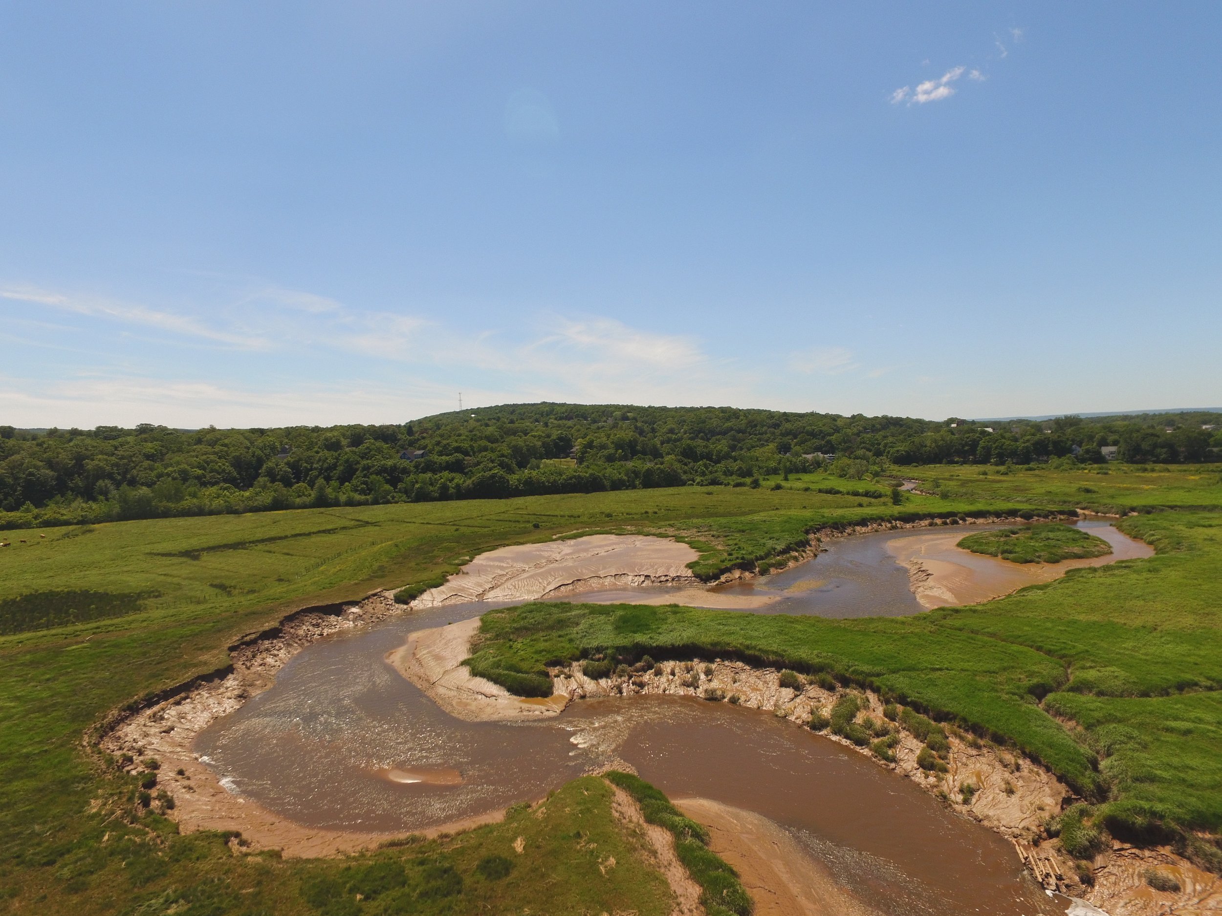
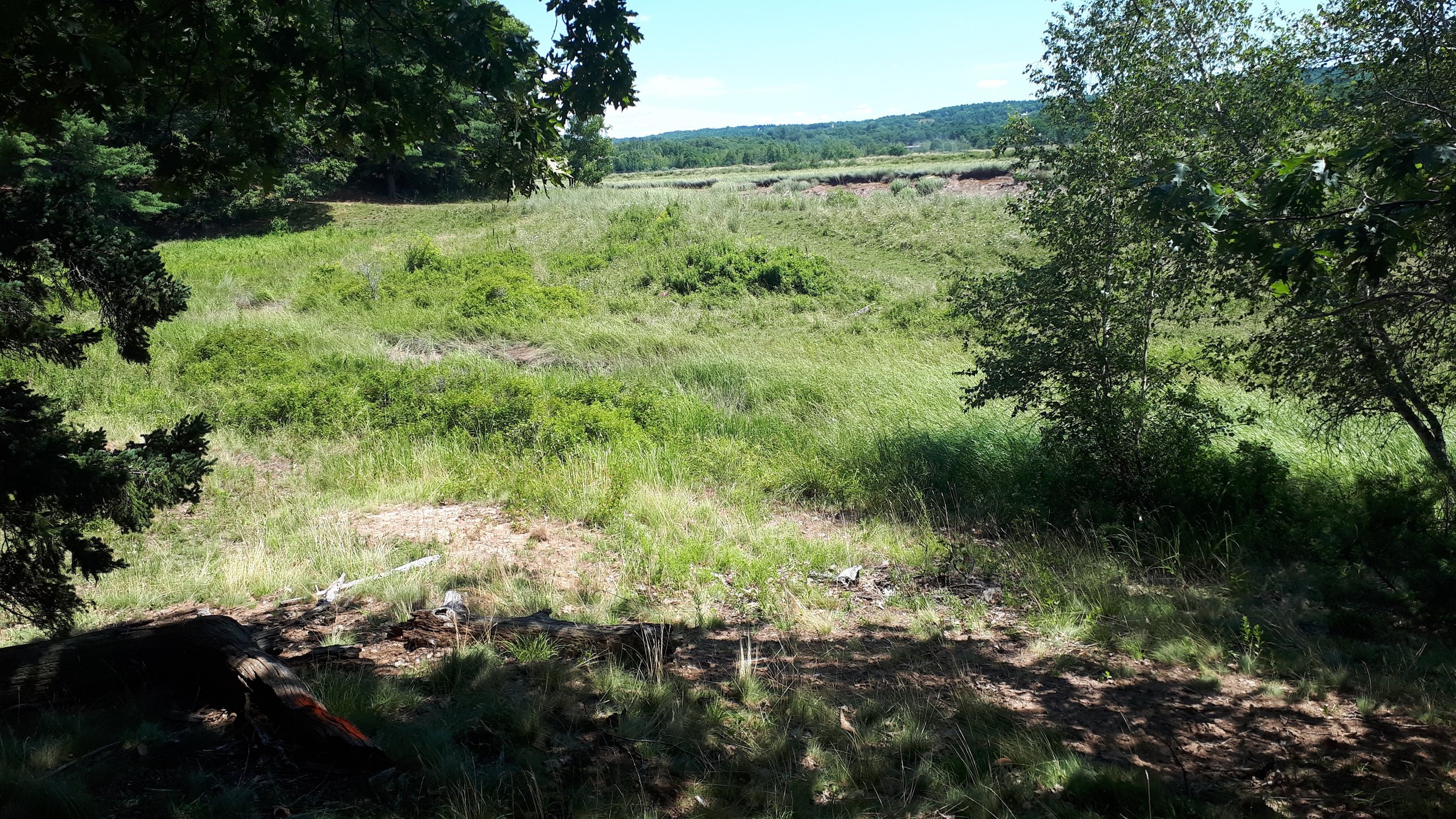
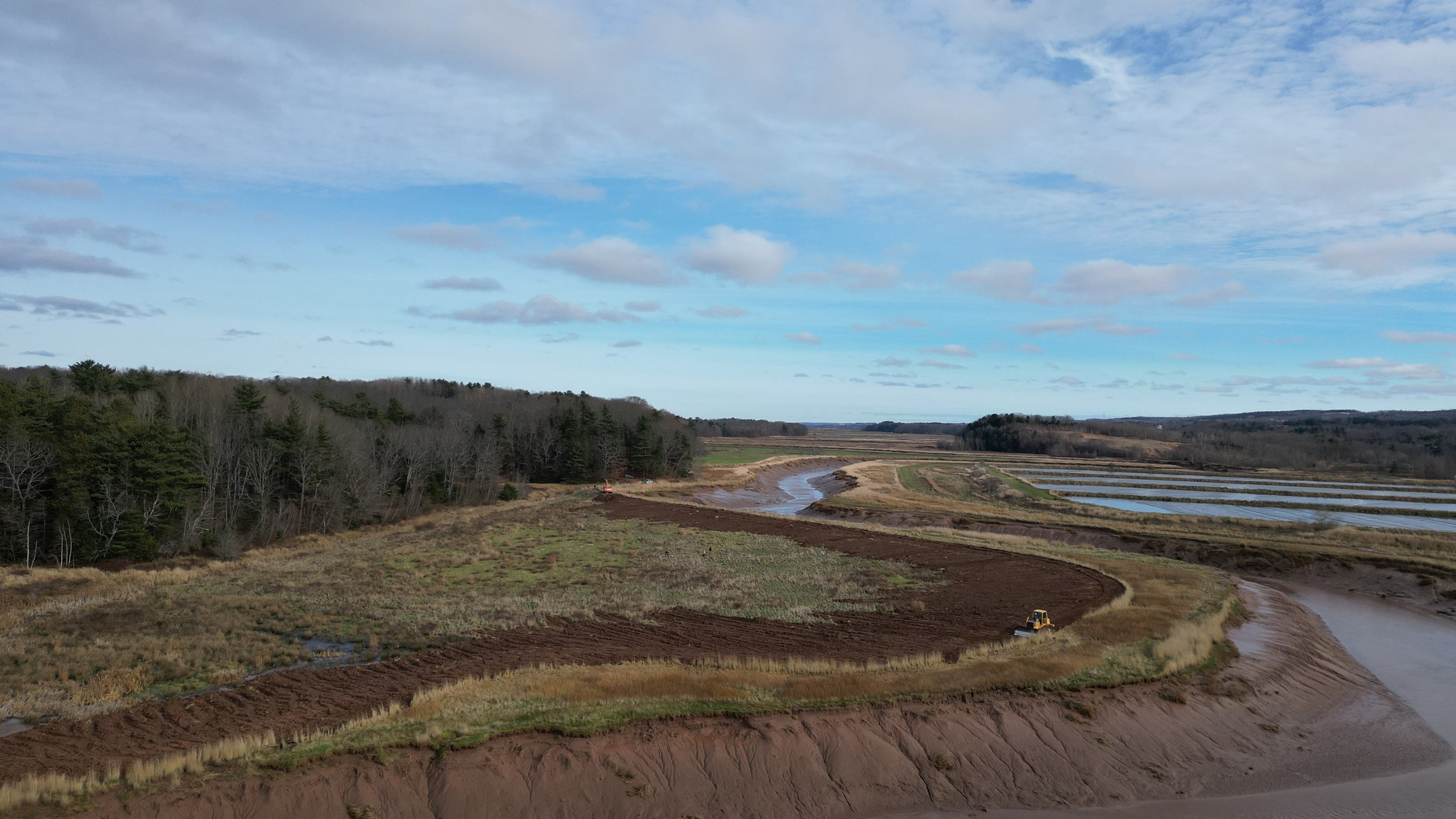
A completed managed realignment project at Belcher Street Marsh, near Kentville, N.S.
Due to factors such as dyking and coastal infrastructure, the majority of these vital ecosystems have been lost in Nova Scotia. Dykes have played a large role in the agricultural history of the Bay of Fundy, but existing dyke infrastructure is vulnerable to erosion and overtopping, and maintenance and repair can be costly, and making managed realignment and tidal restoration a suitable option for some sites. While agricultural dykelands are prime candidates for MR, low-lying communities and infrastructure often rely on existing dykes for protection, and this process is not recommended for every site. Identifying sites for the MRFW project includes assessing vulnerability of the dykes, while also ensuring minimal impact to landowners.
Ksu’Ksw Mqoqt/Hemlock Marsh
Ksu’ksw Mqoqt/Hemlock Marsh is located on the Jijuktu'kwejk/Cornwallis River and downstream of two previously restored sites (Cornwallis Marsh, 2017; Belcher St, 2018). The 523 m section of dyke and the aboiteau in question were both constructed in the 1950s, and protected approximately 13 acres of farmland.
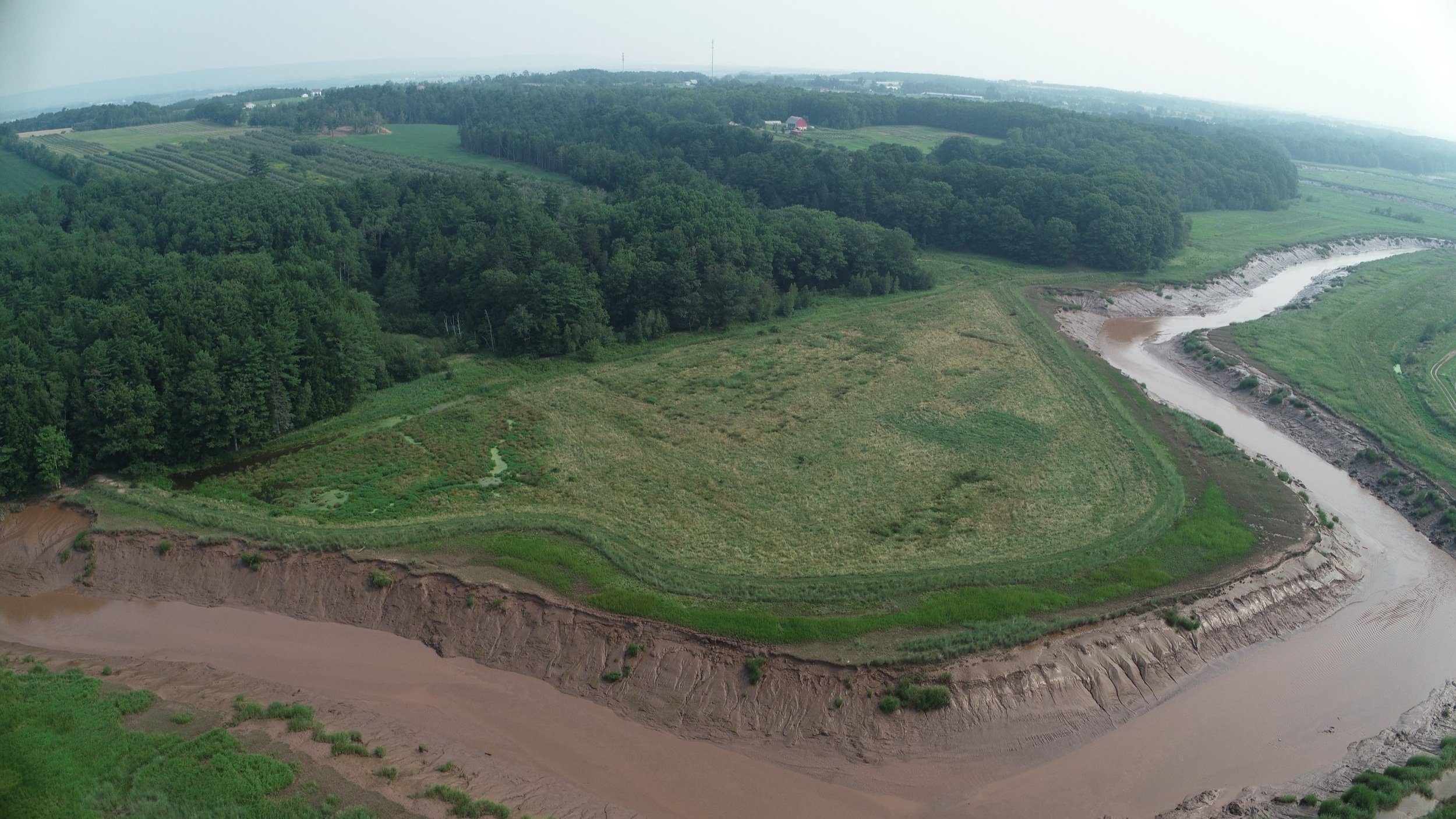
a) Aerial imagery of Ksu’ksw Mqoqt/Hemlock Marsh site, pre dyke-removal

b) Aerial imagery of aboiteau and ravine section of Ksu’ksw Mqoqt/Hemlock Marsh site, pre dyke-removal (November 29th, 2022)
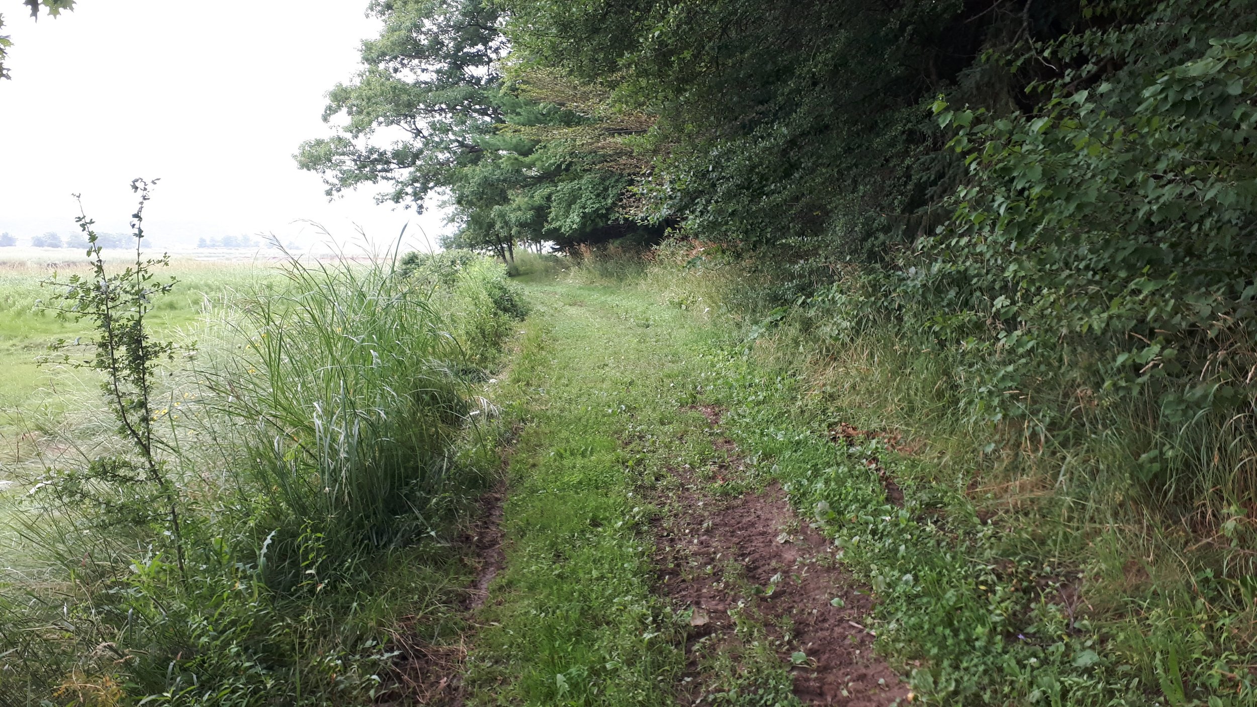
A forested bluff separates the site from upland agricultural lands, and a ravine and agricultural ditch run upstream of the aboiteau. The neighboring section of dyke is accessed by a farm road that runs through the site. The site is currently experiencing erosion along its western edge and flooding, including of the farm road, on spring high tides.
Aboiteau (plural aboiteaux) - A water control structure consisting of a tide gate at the end of a culvert that regulates water flow between a tidewater area and a drained upland area. (NSDA, 2022)

Erosion to toe of the dyke at the western end, pre-restoration
Getting Started
An initial analysis of the site was conducted, in order to understand the following:
The state of the existing dyke infrastructure;
How the site would be affected by the return of tidal floodwaters;
How to develop design concepts that maximize benefits, while protecting any areas of concern.
This initial assessment involved extensive field work and desktop data analysis, including vegetation and habitat surveying, topographical and ecological feature compilation, water level and flood analysis, erosion rates and collecting lots of images (among others)! Another component of the MRFW for this site assessment process includes archaeological assessment and consultation with Mi’kmaq.
There were some important features at this site that were identified:
-
a. Old Wharf Road – this section of road is not expected to see any rapid erosion.
b. Farm Road – this 65m section of road floods at high tides. It was recommended that this section of road be raised.
-
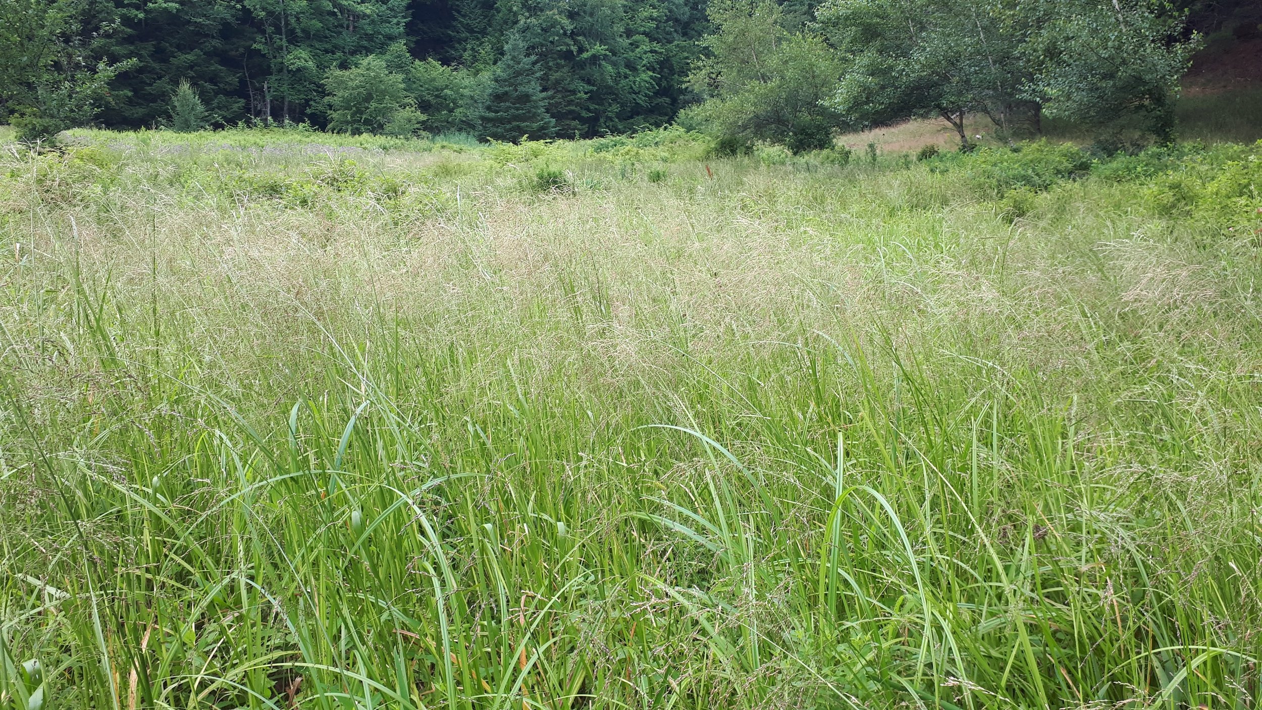
This area has a high water-table, and is dominated by tall grasses, sedges and rushes. It was recommended that this area be allowed to transition to tidal wetland.
-
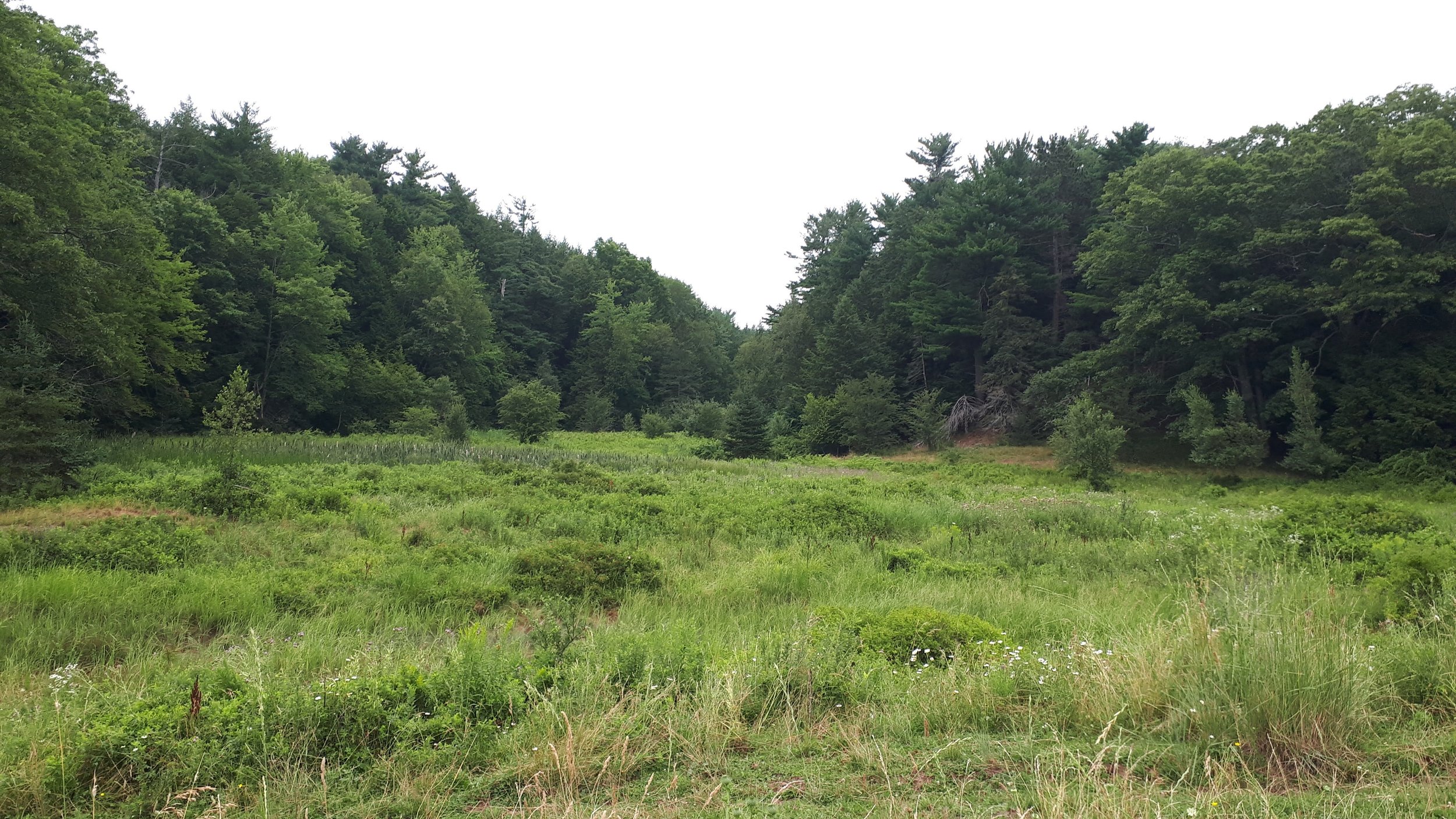
A stand of Eastern Hemlock and White Pine, mostly above the high-water line that was identified by the landowners as old-growth. Based on previously restored sites, there is little risk to the trees above the high-water line, but it was recommended that either a groundwater monitoring program be implemented, or a buffer be placed.
Once we had a good background of the site, multiple designs concepts were created, and all the options were weighed.
How We Moved Forward
Ultimately, the options selected for this site included removing a ~450m section of dyke, and complete removal of the aboiteau, allowing for complete and unimpeded tidal flooding and restoration of hydrological conditions, to allow for the return to a more natural state. The ~30 m of dyke along the Old Wharf Road was to remain intact in order to avoid disturbance to the feature.
The plan also included raising the farm road to above the high-water line and monitoring groundwater and tree health of the stand of old-growth trees.

Aerial imagery of Ksu’ksw Mqoqt/Hemlock Marsh site, pre dyke-removal

Aerial imagery of site after dyke-removal (December 2nd, 2022)
On November 29th and 30th, we began breaching the dyke! CBWES and SMU joined the Confederacy of Mainland Mi’kmaq (CMM), the Nova Scotia Department of Agriculture (NSDA) and Department of Communities, Culture, Tourism and Heritage (NSCCTH), the construction contractor IJ Corkum Excavating, and the landowners, at the site. It was a beautiful day, and the majority of the dyke was successfully graded, leaving only a small section and the aboiteau to go. We were back on site on December 2nd to complete the removal of the remaining portion of the dyke and begin raising the farm road.


Aerial imagery of the site during dyke removal (November 30th). Left: viewpoint from eastern side of marsh. Right: viewpoint from western side of marsh.
Finally, this week our archaeologists headed out with the contractor once more to complete the removal of the aboiteau. On December 5th, the aboiteau was removed, completing the major tasks of the project. That evening’s high tide, we saw success as tidal waters were allowed into the site for the first time in over 70 years – and just like that, we have a “baby marsh”!

Aerial imagery of the aboiteau and channel, before aboiteau removal (December 2nd, 2022)

View of the opened channel after removal of the aboiteau (December 5th, 2022)
What We Expect To See

Three phases of tidal restoration.
Now that the dyke has been breached and the aboiteau removed, we will expect to see the continued flooding of the site, and the process of tidal marsh restoration to begin. The site will enter the brief transition phase, with increased sedimentation and the introduction of new plants. As the site enters the establishment phase, plant communities will become established, we will begin to see less sediment, and increased species competition. Over time we hope to see the site reach equilibrium, with tidal wetland zonation, and stable hydrological processes.

Belcher Street Marsh transitioning from mudflat to wetland following managed dyke realignment in 2018.
The Belcher St Managed realignment site, located upstream of Ksu’ksw Mqoqt/Hemlock Marsh has seen great success, now 5 years post restoration. This site transformed quickly, going from being a mudflat in 2018 to only having 17% bare ground in Year 2 of restoration (2019).
The site saw nearly 0% bare ground by Year 4 of restoration (2021). With similar flooding patterns to those expected for Ksu’ksw Mqoqt/Hemlock Marsh, the Belcher St site is a great example of what we can hope to see in the coming years.
With two now thriving wetlands upstream, restoration at another site along the river will help to increase the resiliency of the river system and reduce the flood risk to the towns of Kentville, New Minas and Port Williams.
To Learn More
To learn more about how tidal wetlands help to protect coastal communities and examples of projects further along the restoration process, keep exploring by visiting the Making Room for Wetlands main page!
If you are interested in learning more about how Nova Scotia is working to protect communities and agricultural land from climate change, the Nova Scotia Department of Agriculture has created a great resource to explain the project. Check out the Working with the Tides Storymap.
-
Department of Fisheries and Oceans Canada (DFO). (2021). Coastal Restoration Fund: Projects in Nova Scotia. Retrieved December 2, 2022; from: Coastal Restoration Fund: Projects in Nova Scotia (dfo-mpo.gc.ca)
DFO. (2019). Coastal Restoration Fund. Retrieved December 2, 2022; from: Coastal Restoration Fund (dfo-mpo.gc.ca)
Nova Scotia Department of Agriculture (NSDA). (2022). Working with the Tides: Protecting communities and agricultural land from climate change. Retrieved December 9, 2022; from: Working with the Tides (arcgis.com)